Downtown Plan and Town Connections
Translate Haysi's downtown priorities into a focused physical-planning and implementation package grounded in the town's buildings, streets, river setting, businesses, and regional recreation economy.
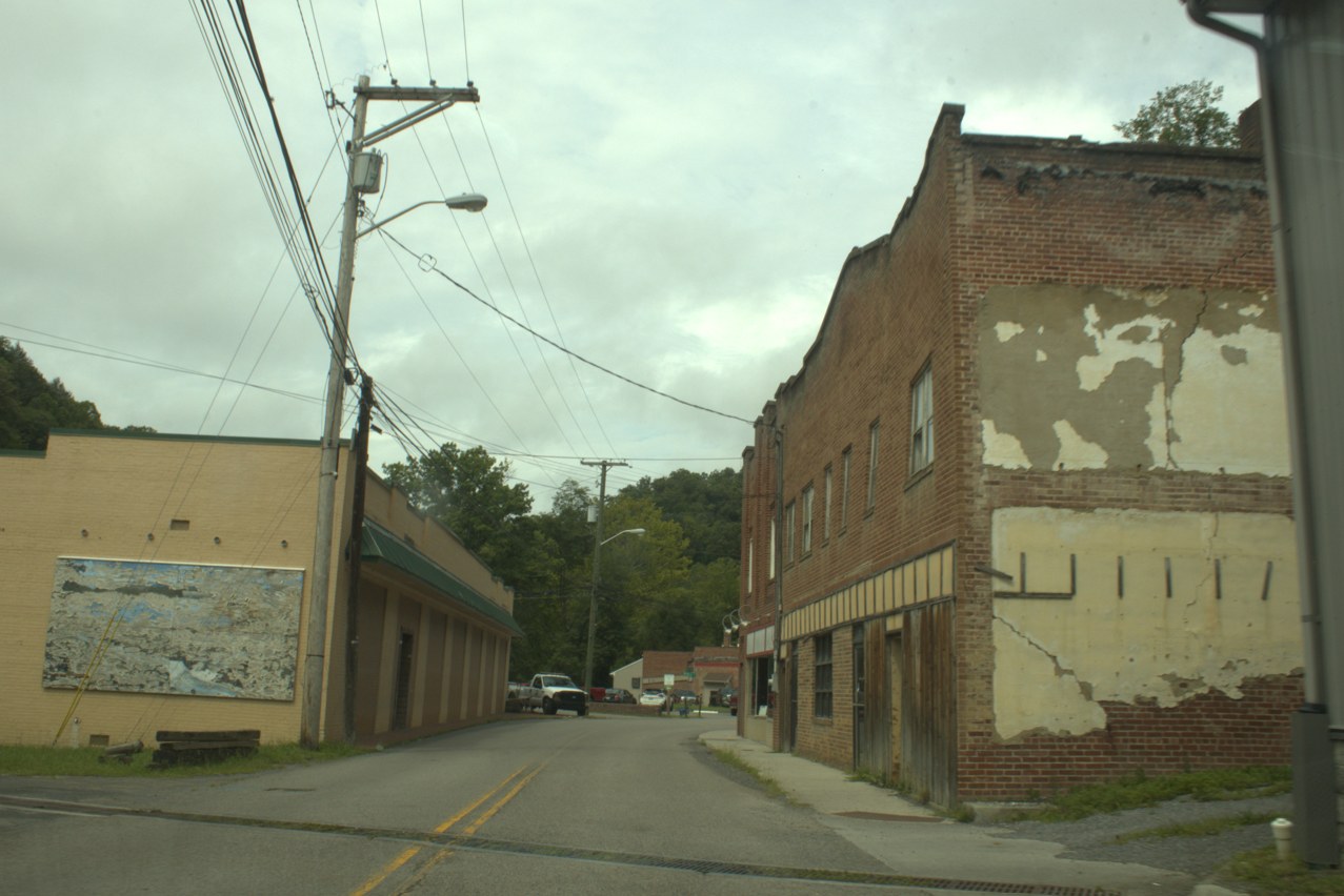
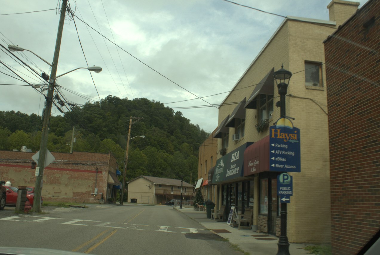
Additional field photographs
These instructor-provided photo albums offer additional context for the project area. Open them in a new tab.
- Downtown Haysi photo album
- Haysi former-school site photo album
- Breaks Interstate Park photo album Regional context for the Haysi project area.
Dickenson project reference materials
These earlier studies and examples are shared across all four Dickenson teams. Start with the material relevant to your site, then compare its assumptions and ideas with current evidence and the work the client has requested.
Open the shared Dickenson folder
Haysi and Clintwood site-development concept study
Structr Advisors' 2023 study examines the former Haysi High School site and the Green-Barnette site near Clintwood. It includes site context, possible uses, regional examples and development approaches.
Open the 2023 concept study (PDF)
The study's Clintwood site is not automatically the same as your assigned housing or downtown-reuse site. Confirm the location before applying its findings. Its conditions and assumptions reflect the earlier study.
Dickenson County floodplain-property playbook presentation
A December 2025 student presentation explores possible reuse of cleared parcels and ideas for downtown Haysi. Study how it organizes property types, alternatives and visual explanations.
Open the earlier presentation (PowerPoint)
These are earlier concepts, not adopted plans or confirmed development permissions. Verify current parcel restrictions, flood information, infrastructure and client priorities. It does not establish Red Onion's industrial-site readiness.
Labeled parcel-layout maps
Earlier maps show parcels labeled as county-owned around Haysi, Clinchco, Nora, McClure and Birchleaf. Card numbers can help you connect the mapped locations to parcel records.
Open the labeled parcel layouts (PDF)
Use the labels as research leads. Check current county GIS and property records; these sheets alone do not establish present title, boundaries, permitted uses or suitability.
Parcel-layout maps without card-number labels
The companion sheet, dated November 1, 2025, provides a clearer view of the earlier mapped parcel pattern, roads and waterways.
Open the companion parcel layouts (PDF)
Read it alongside the labeled sheet. Keep the source date visible, and do not treat the earlier mapping as an up-to-date survey or a substitute for your own analysis.
Use these as references, not as a replacement for your project work. They do not change your committed scope or assignment requirements. Keep source dates and credits when you refer to them.
Confirmed geography
Where the work is focused
Study boundary: Town of Haysi incorporated-place boundary
- Downtown HaysiDowntown focus
37.2053433, -82.2943380 - Haysi former-school siteSite
37.1996352, -82.2936242
Loading Town of Haysi incorporated-place boundary.
Boundary source: U.S. Census Bureau TIGERweb, 2025 incorporated places.
Community driving tour
Dickenson County driving tour: Clintwood to Haysi
This driving tour begins in Clintwood and continues to Haysi, providing visual context for the county's settlement pattern, transportation corridors, terrain, and community character. The route does not visit Red Onion Industrial Park.
Watch the GoPro tourProject purpose
Haysi asked for assistance focused on its downtown. Students may examine the wider town when that context directly helps the downtown work, but the committed assignment is downtown assistance. The team should use existing plans, local knowledge, field observation, and client direction to identify practical improvements and a realistic path forward.
Scope of work
- Review existing plans and prior concepts, then document downtown buildings, streets, circulation, public spaces, river relationships, businesses, recreation assets, and active initiatives.
- Identify the downtown issues and opportunities the client wants the class to address, including reuse, streetscape, wayfinding, gathering spaces, tourism, housing, and connections where relevant.
- Prepare a focused set of illustrated recommendations with priorities, partners, likely funding paths, and practical next steps.
Expected deliverables
- A concise downtown existing-conditions and opportunity analysis
- Illustrated downtown recommendations and any agreed concept alternatives
- A prioritized action plan, implementation sequence, presentation, and editable handoff files
Case studies and precedents
These examples can help you see different ways the work has been done. Treat them as starting points, not prescriptions. Check what is specific to each place and what still needs evidence for your project.
Haysi, Virginia
Russell Fork Trail Center
The former theater was identified in Haysi's earlier downtown planning and later developed as a trail and community center, with funding and floodproofing challenges along the way.
What to study: Follow the long path from a downtown plan idea through funding, design changes, construction, and community use.
Context: A completed project is a precedent to learn from, not a reason to repeat the same concept.
Dickenson County, Virginia
Haysi and Clintwood site-concept study
A 2023 County update described concept work for the former Haysi High School site and a separate green lot on Main Street in Clintwood, including layouts, access, utilities, and traffic questions.
What to study: Notice how a broad idea becomes a set of site questions and alternative layouts before a development decision.
Context: The Clintwood green lot may not be the assigned housing site. The article reports study status in 2023; confirm whether a final report exists. Keep the Haysi and Clintwood team scopes distinct.
Pulaski, Virginia
Pulaski downtown reinvestment
The case follows a downtown plan into reuse of commercial buildings with retail space and apartments, supported by predevelopment assistance and a mix of financing tools.
What to study: Track what happened after planning: property control, tenant research, predevelopment, finance, and implementation.
Context: Pulaski's market and financing conditions are not evidence of Haysi feasibility.
Scope and review parameters
- Downtown assistance is the committed scope; broader town recommendations must directly support that work.
- Existing plans and earlier concepts are starting evidence, not conclusions that must be repeated.
- Concepts must distinguish public action, private-property opportunity, and items requiring further technical or property-owner review.
Treat the list above as the client's full set of needs, not a promise that every item will be completed this semester. In the Work Plan, commit to approximately 50% of what the team is confident it can complete well by the final deadline. The committed scope must be approved by the instructor and client. Additional work may be completed if time allows. The final package should clearly separate near-term actions from items requiring property-owner, design, engineering, environmental, or financial review.
Comparable places
Global Twins
These places face comparable terrain, settlement or economic challenges. Study the documented response, the conditions it depends on, and what differs here. A close analogy is a basis for analysis, not a design to copy or a claim about ancestral origin.
Explore the map and all comparisonsHaysi
A compact river-confluence town with steep wooded slopes and very limited flat land.
Europe
Lynmouth
Devon, England · United Kingdom
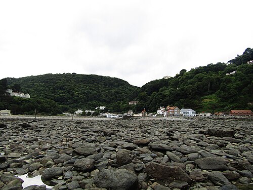
Coastal settlement at the mouth of the East Lyn, between steep wooded valley slopes and the Bristol Channel.
Population: Lynmouth village-only population not separately reported. Devon County Council’s combined Lynton–Lynmouth table reports 750 households, not 750 people.
What happened here
The water-powered funicular opened in 1890 to connect the twin settlements across the steep cliff; it remains an operating heritage railway and visitor link. This documents an access adaptation, not measured economic impact.
Why compare it with Haysi?
A useful landscape analogue for Haysi’s wooded confluence setting and constrained developable land, not a socioeconomic match.
- Small settlement beside a river confluence or river mouth
- Steep, wooded slopes press close to the built area
- Limited flat land concentrates buildings and access
- Water and topography are central to the settlement’s identity
What students should study here
- Treat flood and slope exposure as first-order constraints before promoting visitor uses
- Connect riverfront interpretation with existing walking routes rather than assuming major new construction
- Use the distinct village identity and landscape as a linked visitor story
What differs: Lynmouth is a coastal tourism destination with a harbor and national-park visitor context; Haysi is an inland Appalachian settlement. Similar terrain does not imply similar market demand or hazard conditions.
Virginia project contextSources and geographic scope
Checked September 30, 2026. Population figures retain their year and statistical boundary; a municipal total is not a village count. Locator points are approximate, not surveyed boundaries.
- Census 2021 Report Part 1 – Facts and FiguresDevon County Council
- Lynton and LynmouthVisit Devon
- Lynton & Lynmouth Cliff RailwayLynton & Lynmouth Cliff Railway
Lynmouth, North Devon: Approximate named-place locator, not a survey, parcel or settlement boundary. Coordinate source
Europe
Pont-en-Royans
Auvergne-Rhône-Alpes (Isère) · France
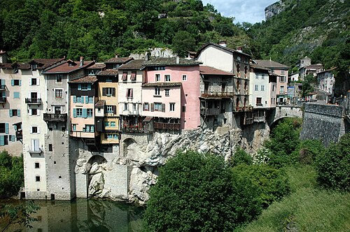
Compact settlement in the Bourne valley at the edge of the Vercors, with steep gorge terrain and a narrow river corridor.
Population: 805 residents, commune population (2023); village built-up footprint is not separately enumerated here.
What happened here
The 16th-century houses project over the Bourne on timber supports; the regional tourism office documents them as an adaptation to the narrow plateau and a built-form response linked to timber trade along the river. No modern redevelopment outcome is claimed.
Why compare it with Haysi?
A strong physical-form comparison for a small settlement compressed between wooded slopes and a river corridor.
- Settlement occupies a narrow valley floor
- Steep wooded slopes constrain expansion
- River is a defining physical feature
- Historic buildings and visitor routes are concentrated in a compact center
What students should study here
- Map the actual buildable land and access pinch points before identifying reuse sites
- Build interpretive walking links around existing river and heritage assets
- Pair visitor access with riverbank and slope stewardship
What differs: Pont-en-Royans has a denser historic core and a Vercors regional visitor economy; the analogy supports form and access questions, not a claim that tourism is transferable at the same scale.
Virginia project contextSources and geographic scope
Checked September 30, 2026. Population figures retain their year and statistical boundary; a municipal total is not a village count. Locator points are approximate, not surveyed boundaries.
- Comparateur de territoires – Commune de Pont-en-RoyansINSEE
- Au fil de la BourneParc naturel régional du Vercors
- Maisons suspendues de Pont-en-RoyansSaint-Marcellin Vercors Isère Tourist Office
Pont-en-Royans: Approximate named-place locator, not a survey, parcel or settlement boundary. Coordinate source
Europe
Sainte-Enimie
Occitanie (Lozère) · France
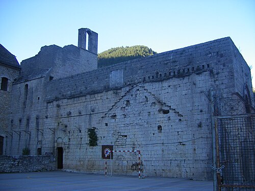
Medieval village in the deeply incised Tarn gorge, between limestone plateaus and steep slopes; access and settlement space are topographically constrained.
Population: Village-only current population not separately reported in reviewed source; 881 is for the enlarged commune of Gorges du Tarn Causses.
What happened here
The regional tourism authority describes the village’s adaptation to its gorge setting through paved lanes, vaulted passages, broad stairs and terraces. This is a documented historic morphology, not a claimed modern redevelopment or economic result.
Why compare it with Haysi?
A landscape and access analogue for a small settlement shaped by a steep wooded river gorge, with important differences in geology and visitor intensity.
- Settlement lies in a confined river valley
- Steep slopes sharply limit flat developable land
- River and surrounding natural landscape shape place identity
- Routes and access are concentrated through a narrow corridor
What students should study here
- Make hazard, ecological carrying capacity and access capacity explicit in visitor planning
- Interpret settlement history through existing paths and buildings
- Protect river edges and avoid treating all constrained land as available for development
What differs: Sainte-Énimie is a recognized medieval tourism destination within a UNESCO-listed cultural landscape region; Haysi is not an equivalent heritage or visitor-market place.
Virginia project contextSources and geographic scope
Checked September 30, 2026. Population figures retain their year and statistical boundary; a municipal total is not a village count. Locator points are approximate, not surveyed boundaries.
- Populations de référence 2023 – Gorges du Tarn CaussesINSEE
- Commune déléguée de Sainte-EnimieINSEE
- Les GorgesEntente interdépartementale des Causses et Cévennes UNESCO
- Sainte-Énimie medieval settlement formTourisme Occitanie
Sainte-Énimie, commune déléguée within Gorges du Tarn Causses: Approximate named-place locator, not a survey, parcel or settlement boundary. Coordinate source
Europe
Corippo
Ticino · Switzerland
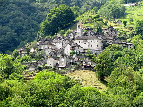
Very small historic stone settlement on a steep wooded slope above the Verzasca valley, separated from the main valley road by a branch access road.
Population: Current village-only population not separately reported in reviewed municipal source; 11 residents is a historical 2018 figure, not current merged-municipality population.
What happened here
The village foundation’s scattered-hotel model adaptively reuses restored historic houses as guest rooms and shared hospitality spaces; the source documents the reuse, not quantified population or economic recovery.
Why compare it with Haysi?
A close small-settlement and steep-terrain comparison that may inform scale-sensitive reuse, while Corippo’s heritage and visitor context are exceptional.
- Very small settlement in a steep, wooded landscape
- Limited flat land and constrained access
- Strong relationship between built form and local terrain
- Place identity is closely tied to landscape and historic settlement form
What students should study here
- Use existing buildings for low-footprint visitor or community functions rather than expanding the footprint
- Link any visitor offer to local stewardship and resident needs
- Track actual resident, business and visitor outcomes instead of assuming that visibility creates population recovery
What differs: Corippo is a protected historic stone village with an established heritage foundation and scattered-hotel model; Haysi’s housing, building stock, economy and governance differ.
Virginia project contextSources and geographic scope
Checked September 30, 2026. Population figures retain their year and statistical boundary; a municipal total is not a village count. Locator points are approximate, not surveyed boundaries.
- CorippoVerzasca municipality
- Valle Verzasca development and projectsVerzasca regional development agency
- Ein Dorf wird zum HotelTicino Tourism
Corippo, Verzasca municipality: Approximate named-place locator, not a survey, parcel or settlement boundary. Coordinate source
Europe
Rjukan
Telemark · Norway
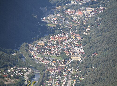
Company town in the Vestfjord valley, enclosed by steep mountains and waterfalls; hydropower and transport infrastructure follow the valley corridor.
Population: Current town-only population not separately reported in reviewed statistical source; available source is for Tinn municipality and is not substituted here.
What happened here
The former Vemork hydropower station now operates as an industrial and social-history museum within the UNESCO-listed Rjukan–Notodden Industrial Heritage Site; preservation and interpretation are documented, without asserting local economic impact.
Why compare it with Haysi?
A useful example of how a constrained mountain-valley town can make its industrial history legible alongside its landscape, but not a close scale or economic twin.
- Steep-sided, geographically constrained valley setting
- Water and terrain are central to settlement character
- Historic transport routes connect valley sites
- Built form and infrastructure are strongly shaped by topography
What students should study here
- Present industrial and community history as a connected place narrative
- Reuse an existing landmark or route as an interpretation anchor
- Separate verified heritage assets from tourism aspirations and measure outcomes over time
What differs: Rjukan was a large, planned hydro-industrial company town and is part of a UNESCO World Heritage property; Haysi is a much smaller Appalachian confluence settlement without that industrial system.
Virginia project contextSources and geographic scope
Checked September 30, 2026. Population figures retain their year and statistical boundary; a municipal total is not a village count. Locator points are approximate, not surveyed boundaries.
- Rjukan-Notodden Industrial Heritage SiteUNESCO World Heritage Centre
- Norwegian Industrial Workers MuseumNorwegian Industrial Workers Museum
- Kommunefakta TinnStatistics Norway (SSB)
Rjukan, Tinn municipality: Approximate named-place locator, not a survey, parcel or settlement boundary. Coordinate source
U.S. Appalachia
Matewan
Mingo County, West Virginia · United States
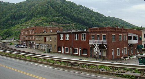
Historic coal town in the Tug Fork valley, with settlement and transport concentrated along the river corridor and adjacent steep Appalachian slopes.
Population: 412 residents, 2020 Census.
What happened here
The National Park Service documents Matewan’s 1920 conflict and the town’s place in the Mine Wars; the historic district preserves the setting for interpretation. This is a heritage-preservation response, not evidence of quantified revitalization.
Why compare it with Haysi?
A strong coalfield and river-valley comparison for Haysi, particularly for the way a small settlement’s labor history and landscape can be interpreted together.
- Small Appalachian valley town shaped by coal and rail-era development
- River corridor organizes settlement and access
- Steep surrounding terrain constrains expansion
- Industrial history remains central to local identity
What students should study here
- National Park Service interpretation places Matewan within the West Virginia Mine Wars story and a designated historic district
- Use place-based interpretation to explain labor, community and industry together rather than reduce the story to scenic tourism
- Tie any visitor route to accurate local history and existing public sites
- Do not infer current employment or community benefit from heritage designation alone
What differs: Matewan’s nationally recognized Mine Wars history and historic-district designation are distinctive; Haysi’s confluence geography and local industrial story require their own evidence and interpretation.
Virginia project contextSources and geographic scope
Checked September 30, 2026. Population figures retain their year and statistical boundary; a municipal total is not a village count. Locator points are approximate, not surveyed boundaries.
- State of West Virginia Incorporated Places – 2020 CensusU.S. Census Bureau
- Matewan MassacreU.S. National Park Service
Matewan town, West Virginia: Approximate named-place locator, not a survey, parcel or settlement boundary. Coordinate source
Canadian Appalachia
Grande-Vallée
La Côte-de-Gaspé, Gaspésie–Îles-de-la-Madeleine, Québec · Canada
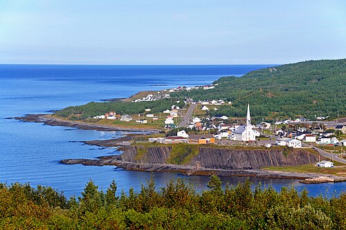
Gaspé Peninsula community between sea and mountains, organized around the Grande-Vallée river valley and Gulf of St. Lawrence coast; not an inland Appalachian coal valley.
Population: 1,077 residents, 2021 Census.
What happened here
The municipal tourism offer links a riverfront promenade, covered bridge, beach and fishing wharves with Espace Esdras-Minville museum. This documents existing visitor/public-realm assets, not measured visitor spending or job effects.
Why compare it with Haysi?
A partial physical analogue for a small river-centred settlement in a steep, wooded region, but its maritime setting and resource economy sharply limit transfer to Haysi.
- Small settlement closely associated with a river corridor
- Surrounding regional landscape combines uplands and water
- Public recreation assets use existing riverfront and paths
- Local identity is tied to landscape and place-specific history
What students should study here
- Municipal tourism information links a riverside promenade, covered bridge, beach, wharves and local museum as a compact visitor offer
- Use an existing riverfront network to connect public spaces and local interpretation
- Coordinate outdoor access with community-serving destinations rather than rely on a single attraction
- Treat this as a coastal-region example, not proof that the same visitor economy fits inland Haysi
What differs: Grande-Vallée faces the maritime Gulf and has coastal access, a municipal tourism network and a different settlement/economic history; Haysi is an inland Virginia confluence settlement.
Virginia project contextSources and geographic scope
Checked September 30, 2026. Population figures retain their year and statistical boundary; a municipal total is not a village count. Locator points are approximate, not surveyed boundaries.
- Census Profile, 2021 Census – Grande-Vallée, MunicipalitéStatistics Canada
- Grande-Vallée tourism and municipal servicesTourisme Gaspésie
- Physiographic Regions of CanadaNatural Resources Canada, Geological Survey of Canada
Grande-Vallée, Québec: Approximate named-place locator, not a surveyed boundary. Coordinate source
Work from the confirmed scope.
Use the community conversation, instructor-provided project needs, and existing documents to keep your work aligned with the client. Confirm any scope change with Tyler before promising it to the community partner.
See all projects