Places facing similar physical and economic challenges. Compare what another community did, what made it possible, and what would have to be different in Southwest Virginia.
40 comparable places match your selection.
Loading verified locator points.
Points locate named communities or estates, not cadastral boundaries. Use the card list as a keyboard-accessible alternative to the map.
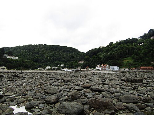
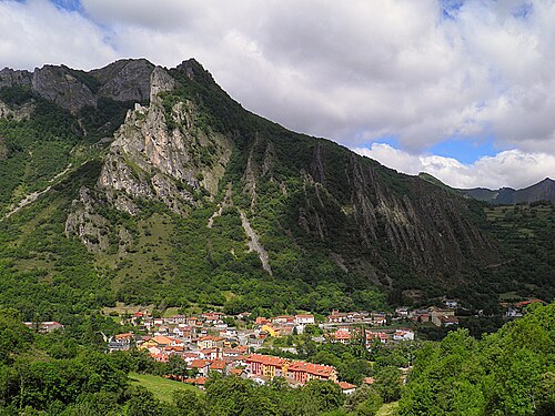
Coastal settlement at the mouth of the East Lyn, between steep wooded valley slopes and the Bristol Channel.
Population: Lynmouth village-only population not separately reported. Devon County Council’s combined Lynton–Lynmouth table reports 750 households, not 750 people.
The water-powered funicular opened in 1890 to connect the twin settlements across the steep cliff; it remains an operating heritage railway and visitor link. This documents an access adaptation, not measured economic impact.
Why compare it with Haysi?
A useful landscape analogue for Haysi’s wooded confluence setting and constrained developable land, not a socioeconomic match.
Small settlement beside a river confluence or river mouth
Steep, wooded slopes press close to the built area
Limited flat land concentrates buildings and access
Water and topography are central to the settlement’s identity
What students should study here
Treat flood and slope exposure as first-order constraints before promoting visitor uses
Connect riverfront interpretation with existing walking routes rather than assuming major new construction
Use the distinct village identity and landscape as a linked visitor story
What differs: Lynmouth is a coastal tourism destination with a harbor and national-park visitor context; Haysi is an inland Appalachian settlement. Similar terrain does not imply similar market demand or hazard conditions.
Checked September 30, 2026. Population figures retain their year and statistical boundary; a municipal total is not a village count. Locator points are approximate, not surveyed boundaries.
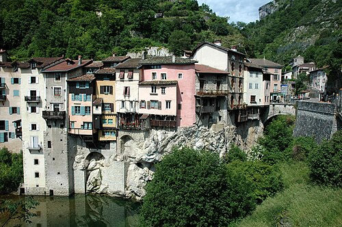
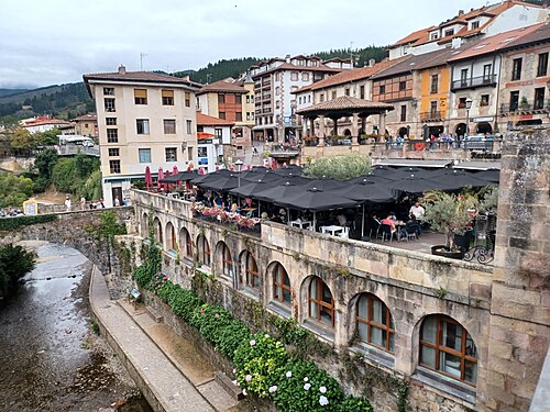
The 16th-century houses project over the Bourne on timber supports; the regional tourism office documents them as an adaptation to the narrow plateau and a built-form response linked to timber trade along the river. No modern redevelopment outcome is claimed.
Why compare it with Haysi?
A strong physical-form comparison for a small settlement compressed between wooded slopes and a river corridor.
Settlement occupies a narrow valley floor
Steep wooded slopes constrain expansion
River is a defining physical feature
Historic buildings and visitor routes are concentrated in a compact center
What students should study here
Map the actual buildable land and access pinch points before identifying reuse sites
Build interpretive walking links around existing river and heritage assets
Pair visitor access with riverbank and slope stewardship
What differs: Pont-en-Royans has a denser historic core and a Vercors regional visitor economy; the analogy supports form and access questions, not a claim that tourism is transferable at the same scale.
Checked September 30, 2026. Population figures retain their year and statistical boundary; a municipal total is not a village count. Locator points are approximate, not surveyed boundaries.
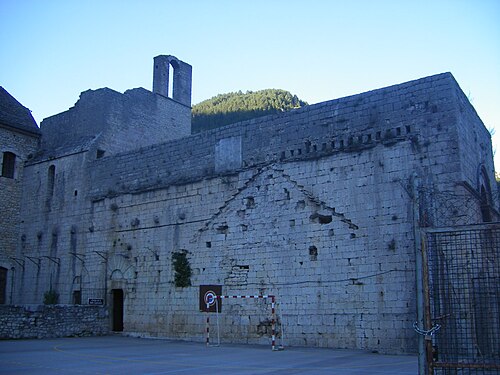
Medieval village in the deeply incised Tarn gorge, between limestone plateaus and steep slopes; access and settlement space are topographically constrained.
Population: Village-only current population not separately reported in reviewed source; 881 is for the enlarged commune of Gorges du Tarn Causses.
The regional tourism authority describes the village’s adaptation to its gorge setting through paved lanes, vaulted passages, broad stairs and terraces. This is a documented historic morphology, not a claimed modern redevelopment or economic result.
Why compare it with Haysi?
A landscape and access analogue for a small settlement shaped by a steep wooded river gorge, with important differences in geology and visitor intensity.
Settlement lies in a confined river valley
Steep slopes sharply limit flat developable land
River and surrounding natural landscape shape place identity
Routes and access are concentrated through a narrow corridor
What students should study here
Make hazard, ecological carrying capacity and access capacity explicit in visitor planning
Interpret settlement history through existing paths and buildings
Protect river edges and avoid treating all constrained land as available for development
What differs: Sainte-Énimie is a recognized medieval tourism destination within a UNESCO-listed cultural landscape region; Haysi is not an equivalent heritage or visitor-market place.
Checked September 30, 2026. Population figures retain their year and statistical boundary; a municipal total is not a village count. Locator points are approximate, not surveyed boundaries.
Sainte-Énimie, commune déléguée within Gorges du Tarn Causses: Approximate named-place locator, not a survey, parcel or settlement boundary. Coordinate source
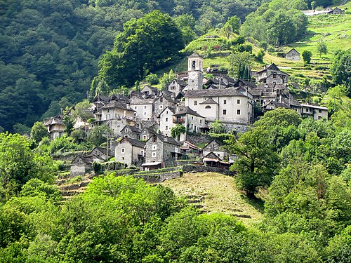
Very small historic stone settlement on a steep wooded slope above the Verzasca valley, separated from the main valley road by a branch access road.
Population: Current village-only population not separately reported in reviewed municipal source; 11 residents is a historical 2018 figure, not current merged-municipality population.
The village foundation’s scattered-hotel model adaptively reuses restored historic houses as guest rooms and shared hospitality spaces; the source documents the reuse, not quantified population or economic recovery.
Why compare it with Haysi?
A close small-settlement and steep-terrain comparison that may inform scale-sensitive reuse, while Corippo’s heritage and visitor context are exceptional.
Very small settlement in a steep, wooded landscape
Limited flat land and constrained access
Strong relationship between built form and local terrain
Place identity is closely tied to landscape and historic settlement form
What students should study here
Use existing buildings for low-footprint visitor or community functions rather than expanding the footprint
Link any visitor offer to local stewardship and resident needs
Track actual resident, business and visitor outcomes instead of assuming that visibility creates population recovery
What differs: Corippo is a protected historic stone village with an established heritage foundation and scattered-hotel model; Haysi’s housing, building stock, economy and governance differ.
Checked September 30, 2026. Population figures retain their year and statistical boundary; a municipal total is not a village count. Locator points are approximate, not surveyed boundaries.
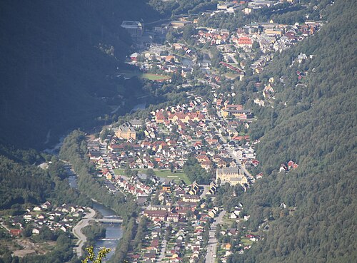
Company town in the Vestfjord valley, enclosed by steep mountains and waterfalls; hydropower and transport infrastructure follow the valley corridor.
Population: Current town-only population not separately reported in reviewed statistical source; available source is for Tinn municipality and is not substituted here.
The former Vemork hydropower station now operates as an industrial and social-history museum within the UNESCO-listed Rjukan–Notodden Industrial Heritage Site; preservation and interpretation are documented, without asserting local economic impact.
Why compare it with Haysi?
A useful example of how a constrained mountain-valley town can make its industrial history legible alongside its landscape, but not a close scale or economic twin.
Steep-sided, geographically constrained valley setting
Water and terrain are central to settlement character
Historic transport routes connect valley sites
Built form and infrastructure are strongly shaped by topography
What students should study here
Present industrial and community history as a connected place narrative
Reuse an existing landmark or route as an interpretation anchor
Separate verified heritage assets from tourism aspirations and measure outcomes over time
What differs: Rjukan was a large, planned hydro-industrial company town and is part of a UNESCO World Heritage property; Haysi is a much smaller Appalachian confluence settlement without that industrial system.
Checked September 30, 2026. Population figures retain their year and statistical boundary; a municipal total is not a village count. Locator points are approximate, not surveyed boundaries.
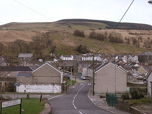
Former coal-mining settlement in the wooded Afan Valley, with steep uplands and a narrow valley floor.
Population: Village population can be assembled from 2021 Census Output Areas, but no ready-made current village total is reported in the reviewed ONS page; do not substitute the broader ward or former community total.
A community cooperative secured Objective One Cydcoed support for an outdoor-pursuits centre, visitor centre and three mountain-bike trails using the forest landscape. The government case study records the assets and programme, not verified net jobs or income outcomes.
Why compare it with Clinchco?
A strong transition analogue for pairing post-coal identity with outdoor recreation, while local scale and visitor evidence need separate evaluation.
Former coalfield valley settlement
Steep wooded terrain and constrained valley-floor development
Industrial heritage remains part of the area’s identity
Outdoor access offers a potential complement to heritage interpretation
What students should study here
Afan Forest Park uses trail networks and heritage features to support outdoor recreation
Glyncorrwg’s mountain-bike centre combines trails with visitor services
Build on existing access assets and community-serving facilities before proposing new attractions
Measure local business participation and resident benefit; tourism presence alone is not an impact estimate
What differs: Glyncorrwg has an established nationally known mountain-bike destination and is close to the M4 corridor; Clinchco is more isolated and has different transport and market conditions.
A second, deliberate association emphasizing small isolated valley settlement and the possibility of converting legacy access/landscape assets into low-impact recreation.
Small settlement in a narrow, wooded upland valley
Mining legacy shapes place narrative
Terrain and transport access constrain options
Nature-based visitation is present in the surrounding landscape
What students should study here
Reuse trails and existing facilities to connect heritage and outdoor recreation
Plan for maintenance, safety and seasonal use as recurring costs
Avoid promising employment or population gains without project-level evidence
What differs: Afan Forest Park has a developed trail system and active visitor infrastructure; Nora’s described isolation and flood vulnerability require a distinct hazard/access response.
Checked September 30, 2026. Population figures retain their year and statistical boundary; a municipal total is not a village count. Locator points are approximate, not surveyed boundaries.
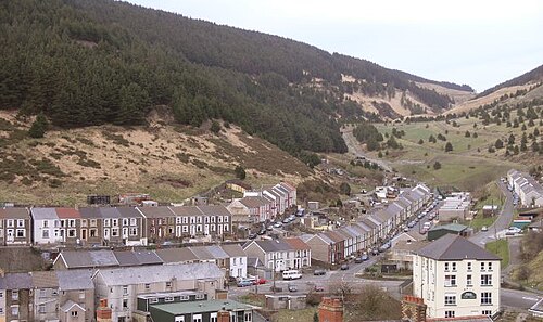
The documented Afan Valley response was based at Glyncorrwg: a cooperative-supported outdoor centre, visitor centre and mountain-bike trails. This is a nearby/regional study lead, not evidence that the programme was located in Blaengwynfi or produced measured local outcomes there.
Why compare it with Clinchco?
A close settlement-form and post-industrial valley comparison; it is a study lead rather than evidence that a specific intervention has produced local economic recovery.
Small settlement in a steep coalfield valley
Former coal industry is central to local history
Limited level land and valley access shape development choices
Nearby natural landscape can complement heritage interpretation
What students should study here
Treat the former industrial landscape as an asset for interpretation, with community voice and accurate history
Connect routes to functioning services rather than building a stand-alone attraction
Use local-level indicators to test whether visitor activity benefits residents
What differs: Blaengwynfi sits within the Afan Valley tourism catchment; Clinchco’s remoteness and market access are different. No comparable economic outcome is established by these sources.
A second deliberate association for Nora’s small, steep, isolated mining-valley context, especially relevant to access and resilience questions.
Compact settlement in steep valley terrain
Mining and rail-era development shaped regional settlement patterns
Constrained route choices and limited flatland
Landscape and industrial memory are linked
What students should study here
Coordinate heritage routes with transport and emergency-access planning
Build a small-scale, locally anchored visitor story around existing assets
Distinguish documented projects from proposed regeneration and measure their results
What differs: The Afan Valley contains established forest-recreation infrastructure; Nora’s described flood vulnerability and isolation call for additional hazard screening.
Checked September 30, 2026. Population figures retain their year and statistical boundary; a municipal total is not a village count. Locator points are approximate, not surveyed boundaries.
Blaengwynfi, Afan Valley: Approximate named-place locator, not a survey, parcel or settlement boundary. Coordinate source
Europe
Lewistown (Upper Ogmore Valley)
Bridgend County Borough, Wales · United Kingdom
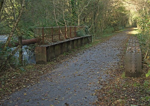
Former railway bridge over the River Ogmore at Lewistown, Wales. eswales · CC BY-SA 2.0
Locality in the Upper Ogmore Valley, between Ogmore Vale and Blackmill; mapped along the narrow valley corridor. Mining legacy is regional and village-specific claims need care.
Population: Village-only population not separately reported in reviewed primary sources. Census geography and any combined built-up-area total need confirmation before use.
The regional heritage booklet documents a valley economy organized around deep and drift collieries and the Ogmore Valley Railway, which carried coal to Porthcawl docks. It provides historical context for Lewistown, not a village-specific modern redevelopment case.
Why compare it with Clinchco?
A supported small-valley and coalfield transition comparison, useful for considering how transport-corridor settlements adapt after mines close.
Welsh Upper Ogmore Valley locality, distinct from the U.S. Lewistown
Settlement lies along a constrained valley corridor
Regional coal mining was a major historical land use
Post-mining settlement functions include commuting and regional service connections
What students should study here
The local heritage booklet frames the Ogmore Valley through coalfield history and landscape, offering a regional rather than single-village interpretation model
Verify which legacy sites and routes are locally accessible before proposing visitor programming
Treat commuter function and regional access as part of the transition story, not as evidence of local job creation
Track village-scale outcomes separately from county-level change
What differs: Lewistown is in the Bridgend/Ogmore context and is reported as a commuter locality; Clinchco’s Appalachian setting, rail legacy and remoteness differ. The sources do not prove equivalent economic trajectories.
Checked September 30, 2026. Population figures retain their year and statistical boundary; a municipal total is not a village count. Locator points are approximate, not surveyed boundaries.
Lewistown, Upper Ogmore Valley, Wales (not the United States place of the same name): Approximate named-place locator, not a survey, parcel or settlement boundary. Coordinate source
The preserved company settlement’s former engineer’s house, chapel and worker/social buildings are interpreted through a guided visit; the regional authority documents the town’s historic services and designation as a cultural asset.
Why compare it with Clinchco?
A strong interpretive analogue for explaining how mining shaped a community, but Bustiello’s planned company-town architecture is not equivalent to Clinchco’s coal-and-rail morphology.
Mining shaped settlement development and community identity
Valley location connects built settlement to extractive landscape
Industrial heritage can support place interpretation
Small-scale visitor programming can use existing buildings
What students should study here
Bustiello’s interpretation centre uses a former engineer’s residence and guided village visits
Interpret the social history of labor and company power alongside architecture
Link individual heritage sites into a regional mining itinerary
Use bookings and visitor counts as outputs, not proof of broader economic impact
What differs: Bustiello is a designed company village built largely 1890–1925 and protected as an Asset of Cultural Interest; Clinchco has a different Appalachian coal/rail history and built form.
Checked September 30, 2026. Population figures retain their year and statistical boundary; a municipal total is not a village count. Locator points are approximate, not surveyed boundaries.
Bustiello mining village, Mieres: Approximate named-place locator, not a survey, parcel or settlement boundary. Coordinate source
Europe
Cwmaman
Rhondda Cynon Taf, Wales · United Kingdom
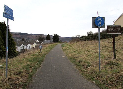
Former railway route from Aberdare to Cwmaman, now a footpath and cycleway. Jaggery · CC BY-SA 2.0
Coalfield village in the Cynon Valley near Aberdare, with compact miners’ housing and streets formed during rapid colliery-era growth.
Population: Current village-only population not separately reported in reviewed source; historical 1841 Aman Valley population of 40 is not a current village count.
Workers organized a wage contribution and a public meeting led to the institute opened in 1892, with reading rooms and a public hall; it was rebuilt after a 1896 fire and later expanded. This is documented historic civic infrastructure, not a modern redevelopment claim.
Why compare it with Clinchco?
A supported coalfield-settlement comparison for how mining shaped village form, community facilities and local identity; it does not establish a specific post-closure reuse outcome comparable to an industrial park.
South Wales coalfield village whose development followed nearby collieries
Miners’ housing and streets grew rapidly with industrial employment
Railway-era place names and industrial infrastructure are part of the settlement story
Mining shaped social institutions and community life beyond the workplace
What students should study here
Rhondda Cynon Taf’s heritage account links Cwmaman’s growth to three large collieries and describes worker housing and amenity needs
It documents a miners’ institute built through worker contributions and community action, illustrating a social-infrastructure lesson rather than industrial-land conversion
Map surviving civic and heritage buildings before proposing adaptive reuse
Do not conflate this Cwmaman with Carmarthenshire’s Garnant/Glanaman community or import its Raven Industrial Park case
What differs: Cwmaman is a coal-mining village near Aberdare; Clinchco’s rail geography, isolation and contemporary assets differ. The cited Cwmaman source documents historical development, not present-day employment or land-reuse outcomes.
Checked September 30, 2026. Population figures retain their year and statistical boundary; a municipal total is not a village count. Locator points are approximate, not surveyed boundaries.
The Valle de Samuño Mining Ecomuseum reuses the mining railway and Pozo San Luis for a train-and-mine visitor route connected to La Nueva. It preserves and interprets industrial infrastructure; the source does not establish replacement employment or community-wide economic success.
Why compare it with Nora?
A strong post-extractive valley analogue for Nora’s scarce flatland and rail/creek setting, with a documented community-driven heritage reuse example.
Small settlement embedded in a wooded extractive valley
Mine and transport infrastructure shaped local form
River and rail corridors organize access through constrained terrain
Industrial legacy coexists with natural landscape
What students should study here
A community-demanded project recovered the San Luis mine and railway route as the Valle de Samuño Mining Ecomuseum, opened in 2013
The visitor experience connects train, former mining tunnel, shaft buildings and landscape interpretation
Integrate industrial interpretation with protected-landscape routes
Report the established attraction as an implemented heritage project; the sources do not establish net job or population effects
What differs: La Nueva is part of Asturias’ large historic coalfield and is embedded in a designated protected landscape; Nora’s local industrial scale, current assets and hazard exposure require independent verification.
Checked September 30, 2026. Population figures retain their year and statistical boundary; a municipal total is not a village count. Locator points are approximate, not surveyed boundaries.
Welsh coalfield settlement in a wooded upland valley; a former colliery feeder pond and reclaimed mine land form a local landscape feature.
Population: Current village-only population not separately reported in reviewed official sources; verify the relevant census geography before using a number.
The council identifies the former colliery feeder pond and reclaimed mine land as an open-access lakeside recreation and nature-reserve setting, with paths and mining-history interpretation. A separate proposed Outdoor Gateway was later recorded as not progressing, so it is not presented as delivered.
Why compare it with Nora?
A useful analogue for linking former extractive land, watershed landscapes and community recreation, with an explicit reminder that a proposed project is not an implemented outcome.
Former mining landscape in a steep valley
Water features and wooded slopes are visible parts of place identity
Post-industrial land can serve ecological and community functions
Recreation and heritage can be combined at a small scale
What students should study here
The former Cwmtillery Colliery feeder pond and reclaimed mine area now provide open access, paths and seating
Council identifies mining history through lakeside sculpture and local nature-reserve status
A prior planning description proposed an outdoor gateway/education centre and trails; a later plan says that initiative is no longer progressing, so do not describe it as delivered
Screen flood, ecology and site ownership before proposing new facilities
What differs: The implemented lakeside access and nature features are not evidence of a completed outdoor visitor centre or proven economic transition; Nora’s flood exposure needs its own assessment.
Checked September 30, 2026. Population figures retain their year and statistical boundary; a municipal total is not a village count. Locator points are approximate, not surveyed boundaries.
Village in the upper Conwy valley, built mainly to house workers at Cwm-machno slate quarry; associated with a remote upland slate landscape and historic quarry transport routes.
Population: Village-only population not separately reported; Bro Machno community population was 629 in Census 2021.
The former chapel was converted into a village community centre, with a heritage room added in 2012; the former school was also adapted as a residential centre. These are documented building reuses, not quantified regeneration outcomes.
Why compare it with Nora?
A useful extractive-valley analogue for Nora’s small scale, constrained access and legacy infrastructure, with slate quarrying rather than coal mining as the key industry.
Small Welsh settlement in a narrow upland valley
Extractive industry shaped the settlement and local employment
Historic transport links carried mineral output through the valley
Community heritage assets reuse existing buildings and interpret local history
What students should study here
Coflein records that the former school became a residential centre and a former chapel became a community centre with a heritage room
The case shows reuse of civic buildings for continuing community and interpretation functions, not just visitor attractions
Pair industrial interpretation with housing, services and everyday community use
Do not infer population recovery or economic impact from building reuse alone
What differs: Cwm Penmachno’s slate-quarry landscape and Conwy geography differ from Nora’s specified coal/rail/creek context; no comparable flood outcome is asserted.
Checked September 30, 2026. Population figures retain their year and statistical boundary; a municipal total is not a village count. Locator points are approximate, not surveyed boundaries.
Sobirà 20-30 is a territorial strategic plan jointly promoted by the Pallars Sobirà County Council and the Municipality of Sort, with participation by the comarca's other 14 municipalities; it is designed to prioritize implementable cross-municipal projects. The council also reports a 2026 50% IBI reduction for 56 homes entering social rent in Sort. The cited material documents a plan and a tax measure, not downstream housing or economic outcomes.
Why compare it with Clintwood?
A small mountain administrative and service centre for a much larger rural territory. This is a functional analogue, not a claim that the economies or governmental systems are alike.
small incorporated town serving a rural hinterland
mountain terrain shapes access and settlement
regional public and commercial services concentrate in the centre
town-scale land and infrastructure decisions affect a wider rural catchment
What students should study here
Map regional services and travel catchments separately from municipal boundaries.
Coordinate transport, utilities, and public facilities with surrounding rural jurisdictions.
Protect a compact centre while recognizing terrain constraints on expansion.
What differs: Sort is the comarca capital in Catalonia and is embedded in Spanish regional and municipal structures; Clintwood is a Virginia town within Dickenson County. Sort's Pyrenean economy and cross-border European context are not proxies for Appalachian coal-transition conditions.
Checked September 30, 2026. Population figures retain their year and statistical boundary; a municipal total is not a village count. Locator points are approximate, not surveyed boundaries.
Cantabria announced rehabilitation of the former La Serna schools in Potes as the future Escuela de Cocina y Gastronomía, with a professional training cycle intended for 2026-2027 and reported investment of about €1.5 million. The documented purpose is to extend hospitality training serving Liébana; the project was still being prepared/constructed in the cited 2026 announcement, so no enrollment or employment outcome is claimed.
Why compare it with Clintwood?
Potes is documented as a comarca service and attraction centre; its regional-service role makes it a useful comparator for Clintwood's rural service-hub question, but its tourism-oriented economy is a major distinction.
small town serving a broad mountain hinterland
mountain geography constrains access and development
services and public facilities are concentrated in the town
regional identity and local heritage support economic activity
What students should study here
Assess service catchments beyond town limits before locating public facilities.
Pair visitor-economy investments with year-round services and resident needs.
Treat regional access and utility reliability as economic-development infrastructure.
What differs: Potes is described by Spanish tourism authorities as central to Liébana and by Spain's environment ministry as its service pole; tourism is prominent. Clintwood's comparison should focus on rural service centrality, not copy a tourism-led strategy.
Checked September 30, 2026. Population figures retain their year and statistical boundary; a municipal total is not a village count. Locator points are approximate, not surveyed boundaries.
Ibias's 2022 Tourism Sustainability Plan/Cohesion Action is reported by the municipality as including a bridge upgrade on the El Bao–La Collada tourism path, safety improvements on the San Antolín tourism trail, route mapping/signage/marking across the concejo, and bicycle-repair facilities. The municipality lists project costs; this is evidence of named works and reported execution, not quantified visitor or business results.
Why compare it with Clintwood?
The strongest parallel is a small settlement functioning as an administrative/service centre within a dispersed rural mountain territory, with remoteness and weak communications explicitly identified by Ibias's municipality.
small administrative centre serving a dispersed rural population
mountainous terrain and difficult access
public services and local administration concentrated in a central settlement
economic development must address both town-centre needs and outlying communities
What students should study here
Inventory service access by settlement rather than relying on municipality-wide averages.
Coordinate road, communications, and service planning for remote communities.
Design tourism and heritage actions as complements to everyday economic and public-service needs.
What differs: Ibias is a very dispersed Asturias municipality with 77 settlements and extensive forest land; Clintwood is a distinct incorporated town in a coalfield county. No village-level population is asserted.
Checked September 30, 2026. Population figures retain their year and statistical boundary; a municipal total is not a village count. Locator points are approximate, not surveyed boundaries.
The municipality's 2024 mid-term report documents a coordinated thermalism relaunch project presented by SEMTTAX and a €3.7 million recapitalization involving the municipality and public partners before the operating concession ended. This is a funded/relaunch effort, not evidence that visitor demand, revenue, or long-run viability targets were achieved.
Why compare it with Clintwood?
A small mountain town with a service-centre role and a place-specific economic asset; the useful planning comparison is how to connect the town's distinctive industry/amenity base to year-round community needs.
small town in a mountain region
central-place role within a wider rural area
constrained geography affects circulation and development
economic strategy must link local assets with services and infrastructure
What students should study here
Treat the central business area and public realm as part of the service network, not just visitor scenery.
Use place-specific assets to diversify rather than assume they can replace all legacy employment.
Track resident population and seasonal/second-home effects as different measures.
What differs: Ax-les-Thermes is a thermal spa and mountain recreation destination, not a coal-transition analogue. INSEE reports 1,285 residents for the whole commune in 2023; 78.6% of dwellings were secondary/occasional residences, so seasonal pressure matters.
Checked September 30, 2026. Population figures retain their year and statistical boundary; a municipal total is not a village count. Locator points are approximate, not surveyed boundaries.
Ax-les-Thermes: Approximate named-place locator, not a survey, parcel or settlement boundary. Coordinate source
Europe
Pola de Somiedo (La Pola Somiedo)
Somiedo, Asturias · Spain
Pola de Somiedo beneath surrounding mountains, Asturias. Carmenmoran · CC BY 4.0
Small settlement in the Cantabrian Mountains, within Somiedo municipality and the Somiedo protected natural area; the town is the municipal seat.
Population: Village population not separately reported in the official source reviewed; Somiedo municipality population must not be assigned to Pola de Somiedo
The Municipality of Somiedo initiated environmental review of a named visitor reception and tourism-flow management facility for the Natural Park in 2026. Separately, MITECO documents the operating all-year reception/interpretation centre in Pola, zoned visitor routes, and the park's European Charter for Sustainable Tourism accreditation. The new facility is a proposal under environmental assessment, not a completed project.
Why compare it with Clintwood?
A small settlement acting as the administrative centre for a low-density mountain municipality offers a bounded comparison about service concentration and balancing conservation with community viability.
mountain settlement with a wider rural catchment
administrative services concentrated in a small centre
terrain and distance shape access to services
local economic choices must account for landscape and community assets
What students should study here
Map where municipal services are located and how remote residents reach them.
Connect conservation and recreation management to local businesses and resident needs.
Do not conflate a settlement's population with the municipality or protected-area population.
What differs: Somiedo's protected landscape and nature-based visitation differ from Clintwood's Appalachian coalfield and administrative context. Village-level population is not asserted; available municipal data cannot be substituted.
Checked September 30, 2026. Population figures retain their year and statistical boundary; a municipal total is not a village count. Locator points are approximate, not surveyed boundaries.
Upland South Wales industrial town within a broad coal-and-iron cultural landscape, with mines, ironworks, transport infrastructure, workers' housing, and surrounding upland landforms.
Population: Town population not stated in the current sources cited; older UNESCO-linked source reports approximately 6,000 circa 2000, not a current estimate
Big Pit National Coal Museum operates guided underground tours in the preserved mine. Separately, Torfaen's Townscape Heritage Programme completed a £1.9 million town-centre heritage regeneration project in March 2025. The UNESCO property management system coordinates conservation, planning controls, interpretation and visitor management. No unverified visitor, employment or regeneration-success totals are asserted.
Why compare it with Bluefield, Virginia?
A close analogue for the combination of a small Appalachian town, coal/rail history, historic downtown fabric, and the need to connect heritage assets to present-day regeneration. Similarity is functional and historical, not a claim of identical scale or institutions.
mountain or upland setting shaped industrial settlement
coal extraction and rail/industrial infrastructure influenced town development
historic downtown and worker-built fabric remain visible assets
economic transition requires linking heritage conservation with community regeneration
What students should study here
Use a coordinated landscape-scale plan that connects downtown buildings, industrial sites, transport remnants, and the surrounding terrain.
Pair heritage reuse with everyday community functions, skills, and local business activity; visitor facilities alone are insufficient.
Use a partnership across municipal, heritage, museum, community, and land-management bodies.
Protect views and setting while evaluating new development and reuse proposals.
What differs: Blaenavon's UNESCO-listed property is a 3,310-hectare landscape with ironmaking and coal mining from the Industrial Revolution; Bluefield, Virginia is an incorporated American town shaped by late-19th-century railroad/coal growth. Do not substitute Bluefield, West Virginia.
Checked September 30, 2026. Population figures retain their year and statistical boundary; a municipal total is not a village count. Locator points are approximate, not surveyed boundaries.
Mountain town in Romania's Banat region with a coal-mining industrial heritage and a local government strategy platform that includes an integrated urban development strategy to 2030.
Population: 5,521 (resident population, 1 December 2021; Anina town UAT including component localities)
CFR Călători operates the Oravița–Anina route as a tourist rail service; its tariff effective 14 December 2025 describes the 33 km mountain route and required seat reservations. A local integrated territorial strategy also identifies rehabilitation of Anina station and the Oravița station area as gateways in a multi-town cultural/industrial route. Station rehabilitation is planned work, not a claimed completed project.
Why compare it with Bluefield, Virginia?
A coal-legacy mountain town with an explicit local development strategy is a useful comparator for Bluefield's transition planning, especially for how to frame diversification and place assets; strategy statements are plans, not proof of completed outcomes.
mountain town with coal-mining legacy
industrial employment history shapes identity and redevelopment needs
town-scale strategy can connect infrastructure, services, and economic diversification
heritage and nature-based attractions are considered as economic assets
What students should study here
Translate a broad strategy into named, costed actions with lead agencies, funding sources, and measurable milestones.
Treat mine heritage and trails as one diversification strand rather than assuming tourism alone replaces lost employment.
Build partnerships with other former mining regions for technical exchange, while testing transferability locally.
What differs: Anina is in Romania and its SIDU 2030 is a stated strategy; this evidence does not establish which actions are funded or completed. Bluefield, Virginia has distinct U.S. governance, rail, and labor-market conditions.
Checked September 30, 2026. Population figures retain their year and statistical boundary; a municipal total is not a village count. Locator points are approximate, not surveyed boundaries.
Upland slate-mining town in the Ffestiniog component of the Slate Landscape of Northwest Wales serial World Heritage property; quarry workings, railways, settlements, and transport routes form one landscape.
Population: 3,763 approximate Census 2021 built-up-area estimate, summed from census output areas assigned to ONS BUA W45000158; ONS does not present this derived sum as an official exact population count and boundary alignment may be imperfect.
Gwynedd's regeneration programme links the Blaenau Ffestiniog Community Destination Plan to town-centre regeneration and linking local attractions. Current visitor products include Ffestiniog Railway services to Blaenau and Llechwedd's guided Deep Mine Tour and slate-cavern adventure activities. The Slate Landscape plan sets specific community destination, interpretation, and visitor-management actions. These are documented programs, not proof of community-wide economic gains.
Why compare it with Bluefield, Virginia?
A strong industrial-town comparison for how a small upland community can interpret a former extractive economy as a linked landscape of town, mine, transport, and work culture.
upland town shaped by extractive industry
industrial transport corridors connected work sites to markets
historic town fabric is part of a wider industrial landscape
post-industrial identity and economic diversification are ongoing planning concerns
What students should study here
Plan at landscape scale while preserving the distinct role and needs of the town centre.
Link trails, transport heritage, industrial sites, and living community destinations into a coherent offer.
Use formal setting and views protections when assessing energy, infrastructure, or new development proposals.
Keep resident needs and Welsh-language/community identity visible alongside visitor interpretation.
What differs: The listed property is specifically the Slate Landscape of Northwest Wales, not a Blaenau-Ffestiniog-only UNESCO site. Its slate-quarrying, Welsh-language, and regional planning context differs from Bluefield's coal/rail history.
Checked September 30, 2026. Population figures retain their year and statistical boundary; a municipal total is not a village count. Locator points are approximate, not surveyed boundaries.
Historic mining town set on steep slopes in the Štiavnické Vrchy, surrounded by mining, metallurgical, and water-management works within a UNESCO property of 20,632 hectares.
The 2023 update to Banská Štiavnica's UNESCO management plan is a landscape-wide framework for protection and contemporary use of the mining heritage; UNESCO identifies the historic water-management system and reservoirs (tajchy) as core attributes. The Slovak Mining Museum operates guided underground exhibits including the Open-Air Mining Museum and Glanzenberg Mine. The Mining Academy began in the 1760s and ceased in 1919; it is historical heritage, not a current university in Banská Štiavnica.
Why compare it with Bluefield, Virginia?
A close analogue for mining legacy embedded in both downtown form and surrounding infrastructure, and for using an adopted management framework to coordinate conservation, new uses, and regional development.
historic mountain town whose growth depended on mining
industrial and technical infrastructure remains legible in the wider landscape
economic change followed the decline of mineral extraction
heritage protection must be coordinated with viable contemporary uses
What students should study here
Maintain a current management plan with an action plan, protection tools, condition monitoring, and named partner roles.
Inventory industrial systems beyond landmark buildings, including water, transport, and settlement relationships.
Seek adaptive uses for technical monuments while retaining authenticity and integrity.
Coordinate town planning with protected landscape and surrounding municipalities.
What differs: Banská Štiavnica is a medieval precious-metals centre with a sophisticated historic water system and UNESCO World Heritage status; Bluefield is a U.S. coal/rail town. The Slovak statutory and UNESCO framework cannot be assumed transferable.
Checked September 30, 2026. Population figures retain their year and statistical boundary; a municipal total is not a village count. Locator points are approximate, not surveyed boundaries.
Adjacent Catalan and French municipalities in the high Pyrenees and Cerdanya valley, divided by an international border but linked through formal intermunicipal and cross-border service cooperation.
Population: Separate units, not a combined total: Puigcerdà 10,041 residents (2024 provisional); Bourg-Madame 1,182 municipal population (2023 INSEE reference population)
The Hospital de Cerdanya/Hôpital de Cerdagne is an operating cross-border health institution created through a European Grouping of Territorial Cooperation, jointly managed by Catalan and French administrations to serve Cerdanya and Capcir. The Puigcerdà–Bourg-Madame public-law cross-border consortium is a separate local cooperation instrument. These are concrete shared-service institutions; they do not imply identical health-law or funding conditions for U.S. state-border cooperation.
Why compare it with Bluefield, Virginia?
This is primarily a regional-governance precedent: two adjacent municipalities created formal cooperative structures to address shared services across a boundary. The relevance to Bluefield is coordination with Bluefield, West Virginia, not a shared coal-transition claim.
adjacent communities are functionally connected across a jurisdictional boundary
residents depend on regional-scale services and infrastructure
mountain geography makes local and cross-border access important
What students should study here
Define a narrow shared-service problem, then establish a durable intergovernmental instrument and decision process.
Specify participating jurisdictions, service territory, financing, staffing, and accountability in the agreement.
Keep each jurisdiction's population, authority, and obligations distinct while measuring shared service outcomes.
Treat language, legal systems, insurance, and funding rules as design constraints, not details to resolve later.
What differs: Puigcerdà–Bourg-Madame is international and European, with distinct national law and cross-border governance; Bluefield, Virginia and Bluefield, West Virginia are domestic U.S. municipalities in different states. The precedent is cooperation mechanics, not a claim that a transnational health arrangement is directly replicable.
Checked September 30, 2026. Population figures retain their year and statistical boundary; a municipal total is not a village count. Locator points are approximate, not surveyed boundaries.
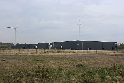
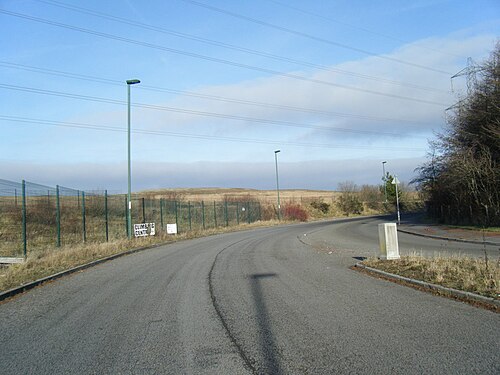
Recontoured former colliery land in the South Wales valleys, with development concentrated on four engineered plateaus and linked by a spine road and cross-valley access infrastructure.
The former colliery was reclaimed and organized into four development plateaus, linked by a spine road and dedicated cross-valley access. Study the relationship between usable platforms, circulation and landscape treatment; the historical reclamation budget is not a current project-cost estimate.
Why compare it with Red Onion Industrial Park?
The clearest engineering-and-delivery comparison: reclaimed mine land, large engineered pads and public access investment used to create a marketable industrial land product.
former mining land reclaimed for employment
engineered flat development areas within valley terrain
public grading, roads and utilities precede business recruitment
landscape and access connect separated development areas
What students should study here
Separate the reclaimed envelope from saleable plateau area.
Relate the access programme to the order in which pads can be marketed.
Use design guidance to connect roads, landscape and individual business plots.
Compare the four-plateau delivery model with Red Onion's three-pad 2025 programme.
Distinguish historic investment, current plot readiness and actual tenant demand.
What differs: Oakdale's advertised estate envelope is much larger. Welsh planning and historical European funding are not U.S. programmes. Its older marketing pages do not establish current vacancy, transport frequencies or construction costs.
400 acres / about 162 ha reclaimed estate envelope; 170 acres / about 69 ha of development plateaus, as reported by the council-linked park website.
Former land use
Oakdale Colliery; reclaimed former mining land.
Terrain
Four recontoured development plateaus, with intervening landscape and valley access constraints.
Pads / phases
Four plateaus. Advertised development-plateau area is not the full 400-acre estate.
Infrastructure
Spine road, entrance roundabout and connections to the adjacent industrial estate; council design brief for layout and landscape.
Access strategy
Sirhowy Enterprise Way and two cross-valley links; the park account dates completion to December 2005.
Business mix
Business, industrial and storage development framework; General Dynamics documents an Oakdale operation in a 2025-issued certificate.
Public investment
Park website reports six years and more than GBP 10 million for reclamation. Historical funding and road-finance arrangements are not 2026 costs.
Development status
Existing business park with developed units and land marketed by the council. Confirm current availability directly; older marketing descriptions are not a live inventory.
Key lesson for Red Onion
Market a connected, phased industrial system, not isolated flat pads. Pair reclamation with credible access, utility and design evidence.
Coal / Mining
Economic Development
Industrial Development
Industrial Park
Post-Industrial Transition
Reclaimed Mine Land
Terrain
Sources and geographic scope
Checked September 30, 2026. Population figures retain their year and statistical boundary; a municipal total is not a village count. Locator points are approximate, not surveyed boundaries.
Oakdale Business Park: Approximate named-place locator, not a survey, parcel or settlement boundary. Coordinate source
Industrial Park Twin
La Curiscada Industrial Estate
Tineo, Asturias · Spain
A rural employment area beside the AS-216 near El Crucero, about 4 km / 2.5 miles from Tineo. Its land programme separates business plots, roads, facilities and green areas.
Tineo developed the industrial estate in successive phases, with later phases supported by mining-region transition funding. The regional inventory documents serviced land and an industrial business mix; the broader municipal estate and Sector 1 have different reported boundaries.
Why compare it with Red Onion Industrial Park?
A close rural industrial-delivery comparison for phased land preparation, mining-transition funding and a business mix rooted in the surrounding working countryside.
rural industrial recruitment outside a town centre
public preparation of serviced business plots
phased development and infrastructure spending
economic diversification in a former mining region
What students should study here
Match parcel sizes to local food, forestry, equipment and service businesses.
Distinguish gross estate area from saleable industrial land.
Trace how three phases and segregated subphases were funded and delivered.
Combine business support with utilities and transport access.
Use a maintained business directory and parcel inventory as marketing evidence.
What differs: The reviewed sources describe municipal land and mining-region funding, not a reclaimed mine at the estate itself. AS-216 frontage and the local food/forestry economy differ from Red Onion's engineered mine-land setting.
33.9241 ha / about 83.8 acres for Sector 1 in the regional inventory. The municipality describes the broader estate as more than 35 ha / 86.5 acres; these are not identical boundaries.
Former land use
Municipal land in a 1990 partial-plan programme; former mine-land use is not established by the source.
Terrain
Road-oriented rural site near Tineo; do not assume Red Onion's pad grades or geotechnical conditions.
Pads / phases
Three development phases, with Phase II split into two subphases; phases are not a verified count of engineered plateaus.
Infrastructure
Water, sewer, electricity and telecommunications; business-promotion centre, streets, green areas and hydrants.
Access strategy
AS-216. Inventory places it about 4 km / 2.5 miles from Tineo and 64 km / 39.8 miles from Oviedo.
Phase I involved SOGEPSA; later phases used mining-region reactivation funds. Source chronology identifies works in 1993, 2003, 2009 and 2010.
Development status
Existing phased estate. Municipal profile reports about 70 businesses, without a clearly stated census date. Regional inventory includes plots offered for sale; confirm current availability.
Key lesson for Red Onion
Design the land product around real rural business demand and phase it with utilities, access and business support.
Economic Development
Industrial Development
Industrial Park
Infrastructure
Post-Industrial Transition
Regional Service Center
Sources and geographic scope
Checked September 30, 2026. Population figures retain their year and statistical boundary; a municipal total is not a village count. Locator points are approximate, not surveyed boundaries.
La Curiscada Sector 1: Regional industrial-estate inventory locator; not a surveyed parcel or the estate boundary. Coordinate source
Industrial Park Twin
Riaño II and III Industrial Estates
Langreo, Asturias · Spain
Industrial land in the Nalón valley: the river separates Riaño II from Riaño I, and a railway separates the Riaño III development from the earlier estate.
SOGEPSA and Langreo developed industrial land in successive phases within the coal-region economy. River and railway corridors separate parts of the estates, making access and utility provision an essential part of parcel development rather than an afterthought.
Why compare it with Red Onion Industrial Park?
A useful post-coal land-delivery twin: public agencies and a municipality phased industrial infrastructure within an established mining-region economy.
public industrial-land preparation
mining-region economic diversification
phased plots and infrastructure
river and transport corridors shape the land product
What students should study here
Separate industrial phase boundaries from river and rail barriers.
Compare agency-led and municipality-led delivery responsibilities.
Relate plot subdivision to a documented business mix.
Include shared utilities, streets, maintenance and business information in the marketing package.
Treat a completed phase and a currently available plot as different claims.
What differs: These are valley-floor estates in a larger urban-industrial corridor, not verified reclaimed mine plateaus. Their established regional business network and agency structure differ from Red Onion.
SOGEPSA delivered Riaño II; Langreo municipality promoted Riaño III with mining-reactivation programmes.
Development status
Inventory lists the phases as existing. Plot availability remains a dated marketing question; do not infer vacancy or economic performance from completion alone.
Key lesson for Red Onion
Make public delivery, plot design, access and ongoing estate services part of the industrial strategy, not just the grading diagram.
Coal / Mining
Economic Development
Industrial Development
Industrial Park
Infrastructure
Post-Industrial Transition
Rail
Sources and geographic scope
Checked September 30, 2026. Population figures retain their year and statistical boundary; a municipal total is not a village count. Locator points are approximate, not surveyed boundaries.
Argame was planned and urbanized through a mining-region diversification programme, with a dedicated highway junction and documented green-space provision. Its river, road and railway setting illustrates how industrial land and environmental infrastructure must be designed together.
Why compare it with Red Onion Industrial Park?
An infrastructure-and-land-balance analogue: a mining-region industrial programme had to coordinate developable plots, river crossings, highway access, services and substantial green areas.
economic diversification in a mining region
publicly prepared industrial land
access infrastructure shapes marketability
development parcels must coexist with environmental and transport constraints
What students should study here
Draw river, road and rail constraints before subdividing industrial land.
Show the access works required to make a plot usable.
Distinguish gross estate area, industrial plots, streets and green-space allocations.
Align utility and drainage responsibilities with the phase programme.
Explain environmental and access constraints honestly in recruitment material.
What differs: Argame is a valley-floor river/highway/rail site, not an established reclaimed mine plateau. Source mining-transition funding does not prove that the land itself was formerly mined.
30.2855 ha / about 74.8 acres gross; inventory allocates 6.2546 ha / about 15.5 acres to green areas.
Former land use
Industrial designation in 1998 and partial plan in 2002; earlier mine use is not established.
Terrain
Caudal River corridor with highway, railway and village edges.
Pads / phases
Single estate phase in the inventory; individual plots are listed, but no engineered-plateau count is given.
Infrastructure
Municipal water and wastewater; separate stormwater collection; industrial street network and green-space allocations.
Access strategy
N-630; the 2002 partial plan incorporated a required double-roundabout access. Access works followed in 2005.
Business mix
Inventory includes trade/rental, food industry, technology, metalwork, construction and logistics.
Public investment
Mining-reactivation funds financed the access programme; urbanization occurred in 2006–2007.
Development status
Existing estate with a public parcel inventory. Reconfirm availability and commercial terms with the promoter rather than relying on undated inventory rows.
Key lesson for Red Onion
The marketable industrial product is the plot plus access, drainage and utility connections, not the plot polygon alone.
Economic Development
Industrial Development
Industrial Park
Infrastructure
Post-Industrial Transition
Rail
Terrain
Sources and geographic scope
Checked September 30, 2026. Population figures retain their year and statistical boundary; a municipal total is not a village count. Locator points are approximate, not surveyed boundaries.
Rassau forms part of the Ebbw Vale Enterprise Zone strategy, which supports industrial recruitment and manufacturing. The published land-area inventory and historical expansion record establish scale and development history, not the amount of land available today.
Why compare it with Red Onion Industrial Park?
A regional industrial-strategy analogue for large employment land, transport investment, manufacturing recruitment and workforce coordination in a former coal-and-steel economy.
post-extractive regional diversification mission
industrial land supported by public planning and infrastructure
large sites intended for manufacturing investment
transport and workforce conditions shape recruitment
What students should study here
Compare gross site boundaries with separately marketed development platforms.
Link industrial recruitment to skills and regional transport investment.
Distinguish approved factory proposals from operating businesses.
Set out landscape buffers and net developable land in site marketing.
Treat an enterprise-zone designation as one policy tool, not proof of demand.
What differs: Rassau is part of a much larger established manufacturing system. A 1976 parliamentary record describes an expansion on common land, not former mine land; the whole estate's prior use must not be generalized from that record.
113 ha / about 279 acres in the Welsh Government's 2019 major-employment-site inventory; this is a dated estate boundary, not a current vacant-land total.
Former land use
1976 Rassau North expansion involved enclosure of 234 acres of common land; reviewed sources do not establish mine-land reclamation across the entire estate.
Terrain
Heads of the Valleys upland industrial setting; individual platforms and buffers are separate development units.
Pads / phases
Council planning documents identify named development platforms; a complete current estate-wide pad count is not reported in the reviewed sources.
Infrastructure
Prepared employment sites, roads and utilities within the wider Ebbw Vale enterprise-zone programme.
Access strategy
A465 Heads of the Valleys corridor; verify current transport services rather than quoting older brochures.
Business mix
Advanced-manufacturing recruitment within the Ebbw Vale enterprise zone; individual proposed projects require separate status checks.
Public investment
Government/council enterprise-zone and regional transport/skills support. Programme-wide budgets are not attributed to this estate alone.
Development status
Existing estate named in the current official enterprise-zone description. Older platform-area and vacancy figures are dated, not asserted as 2026 availability.
Key lesson for Red Onion
Connect industrial land to a regional skills-and-transport strategy, while reporting readiness and actual occupier status separately.
Economic Development
Industrial Development
Industrial Park
Infrastructure
Post-Industrial Transition
Terrain
Sources and geographic scope
Checked September 30, 2026. Population figures retain their year and statistical boundary; a municipal total is not a village count. Locator points are approximate, not surveyed boundaries.
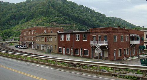
The National Park Service documents Matewan’s 1920 conflict and the town’s place in the Mine Wars; the historic district preserves the setting for interpretation. This is a heritage-preservation response, not evidence of quantified revitalization.
Why compare it with Haysi?
A strong coalfield and river-valley comparison for Haysi, particularly for the way a small settlement’s labor history and landscape can be interpreted together.
Small Appalachian valley town shaped by coal and rail-era development
River corridor organizes settlement and access
Steep surrounding terrain constrains expansion
Industrial history remains central to local identity
What students should study here
National Park Service interpretation places Matewan within the West Virginia Mine Wars story and a designated historic district
Use place-based interpretation to explain labor, community and industry together rather than reduce the story to scenic tourism
Tie any visitor route to accurate local history and existing public sites
Do not infer current employment or community benefit from heritage designation alone
What differs: Matewan’s nationally recognized Mine Wars history and historic-district designation are distinctive; Haysi’s confluence geography and local industrial story require their own evidence and interpretation.
Checked September 30, 2026. Population figures retain their year and statistical boundary; a municipal total is not a village count. Locator points are approximate, not surveyed boundaries.
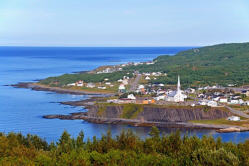
Gaspé Peninsula community between sea and mountains, organized around the Grande-Vallée river valley and Gulf of St. Lawrence coast; not an inland Appalachian coal valley.
The municipal tourism offer links a riverfront promenade, covered bridge, beach and fishing wharves with Espace Esdras-Minville museum. This documents existing visitor/public-realm assets, not measured visitor spending or job effects.
Why compare it with Haysi?
A partial physical analogue for a small river-centred settlement in a steep, wooded region, but its maritime setting and resource economy sharply limit transfer to Haysi.
Small settlement closely associated with a river corridor
Surrounding regional landscape combines uplands and water
Public recreation assets use existing riverfront and paths
Local identity is tied to landscape and place-specific history
What students should study here
Municipal tourism information links a riverside promenade, covered bridge, beach, wharves and local museum as a compact visitor offer
Use an existing riverfront network to connect public spaces and local interpretation
Coordinate outdoor access with community-serving destinations rather than rely on a single attraction
Treat this as a coastal-region example, not proof that the same visitor economy fits inland Haysi
What differs: Grande-Vallée faces the maritime Gulf and has coastal access, a municipal tourism network and a different settlement/economic history; Haysi is an inland Virginia confluence settlement.
Checked September 30, 2026. Population figures retain their year and statistical boundary; a municipal total is not a village count. Locator points are approximate, not surveyed boundaries.
The 1926 coal-camp school, used as a school until 1992, was rehabilitated as an inn beginning in 1993; the Kentucky Historic Schools Survey documents investor and former-graduate involvement and retention of historic fabric. No quantified local economic effect is claimed.
Why compare it with Clinchco?
A close Appalachian coal-company-town comparison with a specific, documented adaptive-reuse lesson in converting a former school into visitor accommodation.
Small Appalachian coalfield community
Company-era development shaped civic facilities and local identity
Historic buildings remain potential community assets
A post-industrial visitor offer can reuse existing structures rather than require a new building
What students should study here
The former Benham school, built in 1926 for coal-camp children and used as a school until 1992, was converted into the Benham Schoolhouse Inn
The Kentucky Historic Schools Survey reports local investors and former graduates funded rehabilitation, with historic fabric retained
A reused school can combine lodging, dining and meeting functions, but needs a viable operating model and capital plan
The documented inn is a project output; the source does not quantify net jobs or broader local economic impact
What differs: Benham’s schoolhouse inn is an operating private lodging asset in a coal-camp context; Clinchco needs its own building inventory, ownership review, visitor-market test and operating partner.
Checked September 30, 2026. Population figures retain their year and statistical boundary; a municipal total is not a village count. Locator points are approximate, not surveyed boundaries.
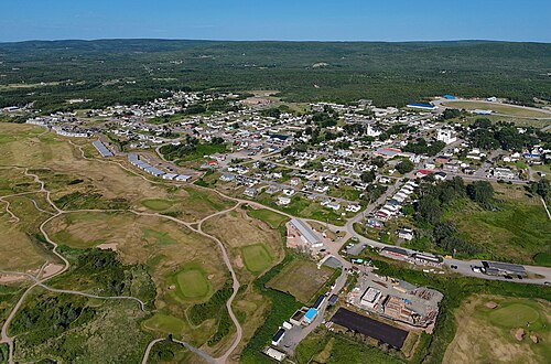
Coastal village on western Cape Breton Island beside the Gulf of St. Lawrence, with a beach, fishing harbour and rolling uplands; not a narrow inland valley analogue.
Population: Village-only population is not separately reported in the cited table; Inverness Subdivision C had 3,167 residents in the 2021 Census.
The Inverness Miners Museum interprets the area’s coal-mining history, and the Historical Society documents local history walks. This is an active interpretation response; sources do not quantify resulting economic effects.
Why compare it with Clinchco?
A useful coal-heritage and recreation comparison, but its coastal setting and beach-based visitor draw differ materially from Clinchco’s inland coal-and-rail valley.
Small community with a documented coal-mining past
Mining history remains visible through a local heritage institution
Outdoor recreation complements place interpretation
Transition planning has to account for a resource-industry legacy
What students should study here
The Inverness Miners Museum preserves and interprets local 19th- and 20th-century coal-mining history
Cape Breton tourism information presents the beach, harbour, boardwalk and outdoor recreation as a wider visitor offer
Connect heritage interpretation with existing recreation assets and local providers
Do not transfer the coastal beach/harbour market strategy to an inland valley without demand evidence
What differs: Inverness is a Gulf coast village with sandy beach and harbour; it is not steep-sided or valley-confined like Clinchco. The comparison is about coal-memory interpretation and diversified recreation, not physical form.
Checked September 30, 2026. Population figures retain their year and statistical boundary; a municipal total is not a village count. Locator points are approximate, not surveyed boundaries.
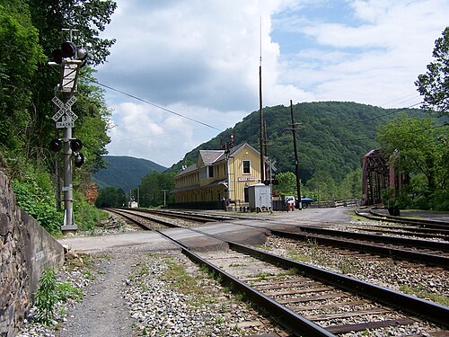
Former coal-and-rail town on a narrow strip in the New River Gorge, where steep rock slopes rise immediately behind the historic town and tracks follow the river corridor.
The National Park Service restored the depot as a seasonal visitor centre and maintains more than 20 historic structures, including ongoing stabilization work. This model depends on federal park stewardship, staff and funding; it is not evidence of a self-financing town-led redevelopment.
Why compare it with Nora?
A close terrain and former coal/rail comparison, but its current heritage model depends on National Park Service stewardship and must not be presented as a self-financing town-centred regeneration model.
Very small Appalachian settlement in steep gorge terrain
Coal and rail shaped the historic economy and built environment
Limited flat land concentrates development in a narrow corridor
Access and flood/river conditions shape how the place can be used
What students should study here
National Park Service restored the depot as a seasonal visitor centre and maintains more than 20 historic structures
NPS stabilization work includes drainage, vegetation removal and exterior repairs, showing ongoing stewardship costs
The case depends on federal park ownership, staffing and preservation funding; this is a major institutional difference from a Virginia town acting alone
Use Thurmond to study asset preservation and access management, not to forecast independent tourism revenue or demographic recovery
What differs: Thurmond sits within New River Gorge National Park and Preserve and has exceptionally low resident population; Nora’s services, ownership, river conditions and institutional support are not equivalent.
Checked September 30, 2026. Population figures retain their year and statistical boundary; a municipal total is not a village count. Locator points are approximate, not surveyed boundaries.
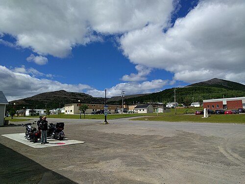
Inland copper company town at about 535 metres elevation in central Gaspésie, surrounded by high mountains, forest and lakes; not a coal town and not a narrow river-confluence analogue.
The municipality promotes named four-season activities including hiking, mountain biking, skiing, snowmobiling, kayaking and fishing after copper mining ended in 1999. This documents the current offer, not replacement jobs, income or quantified visitor success.
Why compare it with Nora?
A useful company-town transition comparison for Nora’s remote, resource-dependent setting, but the industry was copper and its high forested plateau setting is distinct from Nora’s coal/creek context.
Small, remote Canadian Appalachian community shaped by a single extractive industry
Company development influenced municipal formation and housing
Resource dependence created vulnerability when mining ended
Outdoor recreation is promoted as a later diversification pathway
What students should study here
Municipal history records the copper mine closure in October 1999 after ore reserves were exhausted
Official tourism materials now promote year-round outdoor activities including hiking, mountain biking, skiing and snowmobiling
Consider how legacy infrastructure, services and workforce needs change after a dominant employer closes
The sources establish a current recreation offer, not the scale of new jobs or replacement income
What differs: Murdochville was built around copper mining at high elevation among forested mountains and lakes; Nora’s stipulated coal, rail, creek and flood-vulnerability profile differs. Canadian Appalachian physiography is not the U.S. Appalachian Regional Commission service region.
Checked September 30, 2026. Population figures retain their year and statistical boundary; a municipal total is not a village count. Locator points are approximate, not surveyed boundaries.
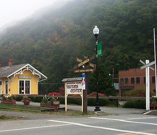
Small Allegheny/Appalachian mountain town on the Greenbrier River, serving as Pocahontas County's seat. The river corridor, surrounding uplands, rail-trail, and mapped flood hazards shape access, recreation, and land-use decisions.
The existing Greenbrier River Trail repurposes the former railroad corridor as a 78-mile state recreation trail with access at Marlinton. The town separately regulates floodplain development using FEMA mapping and local flood-hazard information. These are operating infrastructure and regulatory programs, not claimed economic outcomes.
Why compare it with Clintwood?
A small Appalachian county-seat town that concentrates civic and commercial services for a rural mountain county; this is a service-centre comparison, not a claim that Marlinton shares Clintwood's coal economy.
small incorporated town and county-seat/service role
mountainous rural county hinterland
transport corridors helped shape historical town development
outdoor assets can connect downtown services and local businesses
flood exposure affects parts of the town and public infrastructure
What students should study here
Connect downtown visitor and resident services to a continuous, well-signed trail access network.
Use flood maps and local flood data to steer new facilities away from high-risk locations and protect critical services.
Coordinate town and county investments because the service catchment extends beyond the municipal boundary.
Treat recreation and heritage as diversification opportunities while maintaining year-round local services.
What differs: Marlinton's documented historic industries were timber and railroad, and its current recreation identity is closely tied to the Greenbrier River Trail. Clintwood is a Virginia coalfield county seat with a different industrial legacy. Marlinton's river flood risk is a central land-use constraint.
Checked September 30, 2026. Population figures retain their year and statistical boundary; a municipal total is not a village count. Locator points are approximate, not surveyed boundaries.
Saint-Quentin sits above 300 metres on a plateau in New Brunswick's Appalachian Uplands. The post-2023 municipality has a very large forest-and-farmland territory; the compact town centre remains a local service and business focus.
Population: 2,141 (2021 population centre / former town footprint; pre-2023 boundary). Saint-Quentin's current municipal website reports more than 3,645 residents but does not date that figure; neither is a current post-reform census count.
Saint-Quentin lists a 2025-2029 strategic plan and an Integrated Drinking-Water Source Protection Plan for 2025-2035. New Brunswick's capital plan also lists 1.1 km of Rue Canada storm/sewer, curb/gutter and paving work; the published schedule does not show a funded year, so completion is not asserted.
Why compare it with Clintwood?
A small, French-speaking rural service centre in a forested Appalachian upland with an economy connected to natural-resource, agricultural, and local-service sectors. The lesson is about settlement and service geography, not an equivalent coalfield history.
small town serving a broad rural hinterland
Appalachian upland setting and constrained inter-town access
forestry/agriculture and local services are part of the economy
civic and commercial services concentrate in the town centre
the municipal boundary includes or may include dispersed rural settlements
What students should study here
Map the service catchment and settlement network rather than treating municipal land area as the service area.
Pair forest and farm value-chain development with downtown services, workforce access, and community infrastructure.
Phase land-use, service, and capital plans against the actual post-reform municipal boundary.
Record census geography and municipal boundary dates on every population comparison.
What differs: New Brunswick's municipal amalgamation/annexation took effect 1 January 2023; the 2021 count is for the earlier, much smaller town/population-centre unit. The current municipal site gives an undated population statement. Saint-Quentin is strongly Francophone and its resource base differs from Clintwood's coal economy.
Checked September 30, 2026. Population figures retain their year and statistical boundary; a municipal total is not a village count. Locator points are approximate, not surveyed boundaries.
Saint-Quentin: Approximate named-place locator, not a survey, parcel or settlement boundary. Coordinate source
U.S. Appalachia
Corbin
Southeastern Kentucky (Laurel, Whitley and Knox counties) · United States
Appalachian foothills city at the junction of multiple county and highway service areas. Rail yards and highway corridors shaped its growth; the surrounding regional economy includes manufacturing, logistics, and rural services.
Population: 7,856 (incorporated city, 2020 Census)
The Kentucky Transportation Cabinet's 2025 Statewide Rail Plan documents a feasibility study by the Southeast Kentucky Industrial Development Authority for a potential intermodal facility on underused CSXT property in Corbin. The study is feasibility work, not an approved or built terminal. Corbin's 2015 comprehensive plan separately identifies two industrial parks with over 800 combined acres.
Why compare it with Bluefield, Virginia?
A railroad-shaped regional centre with a historic downtown and contemporary industrial land, where the rail legacy remains a planning asset but new rail use must be tested against current operations and demand.
rail infrastructure influenced town formation and regional access
small-city scale with an economic catchment beyond city limits
historic downtown and industrial areas coexist
transport assets and workforce access are part of diversification strategy
What students should study here
Corbin's current intermodal feasibility study on underused CSXT property is a model for testing rail reuse before promising it.
Coordinate industrial parks, rail yards, highways, and downtown land use as a regional system.
Inventory tenant-ready sites and infrastructure constraints separately from historic rail assets.
Work across counties where the effective labor market and service catchment cross municipal boundaries.
What differs: Corbin's documented industrial strategy includes two parks with more than 800 acres combined and a proposed intermodal feasibility study. Bluefield's coalfield history and Virginia governance context differ. Corbin's 2020 city count excludes a wider three-county trade area.
Checked September 30, 2026. Population figures retain their year and statistical boundary; a municipal total is not a village count. Locator points are approximate, not surveyed boundaries.
Small city on the Restigouche River in northern New Brunswick, near the Quebec boundary and within Canada's Appalachian Uplands physiographic region. It serves a broader rural area with forestry, tourism, and public/commercial services.
Population: Approximately 12,000 residents (new Campbellton municipality, 2023 budget statement; expanded boundary effective 1 January 2023). The 2021 Statistics Canada city count of 6,883 applies to the old city boundary and is not used as current expanded-city population.
Restigouche Regional Service Commission reports completion and approval of the new Campbellton Regional Community municipal plan in its 2025 annual report. In June 2026, federal, provincial and municipal governments announced more than $1.1 million for water/sewer upgrades, including connecting distribution systems between wards. Public Services and Procurement Canada separately documented J.C. Van Horne Bridge bearing, erosion-protection and retaining-wall work coordinated with New Brunswick and Quebec traffic authorities. These are documented governance and infrastructure projects, not quantified growth outcomes.
Why compare it with Bluefield, Virginia?
A rail- and resource-linked northern Appalachian service centre with a regional catchment and post-industrial transition issues. Its current municipal boundaries were enlarged by reform, making governance scale itself an important transferable planning lesson.
small regional city serving rural communities beyond its core
Appalachian mountain/upland regional setting and river corridor
historic resource and transport industries influenced local development
regional service and employment role exceeds the old municipal footprint
land-use and service coordination across neighboring communities is material
What students should study here
Budget and plan at the new municipal/service boundary while preserving neighborhood-scale service data.
Pair business diversification with realistic regional access, workforce, and year-round service strategies.
Map the actual status and function of rail and port assets before treating them as operating freight capacity.
Use regional partnerships to plan workforce, tourism, forestry value chains, and infrastructure.
What differs: Campbellton is a Canadian Francophone/Anglophone border-region city with a 2023 amalgamation that combined Campbellton, Atholville, Tide Head, and parts of local service districts. Its river and forestry/pulp economy differ from Bluefield's coalfield context. The ARC program does not include Canada.
Checked September 30, 2026. Population figures retain their year and statistical boundary; a municipal total is not a village count. Locator points are approximate, not surveyed boundaries.
Campbellton: Approximate named-place locator, not a survey, parcel or settlement boundary. Coordinate source
Industrial Park Twin
Southern Gap Industrial Park
Buchanan County, Virginia · United States
Reclaimed coal-mined mountain land in Buchanan County's Appalachian Plateau. The wider Southern Gap development includes graded, developable areas within a rugged upland landscape; individual usable parcels and pads are much smaller than the controlled development boundary.
The IDA's Southern Gap development has an operating tenant mix, while public agencies continue phase-specific work: VCEDA's 2023 annual report records an up-to-$2.5 million grant for a 20-acre Phase II industrial site; VCEDA later closed $1.6 million in separate 2025 grants for proposed commercial, housing and 130-acre mixed-use projects. These approvals do not establish that the new phases are complete or that projected jobs were realized.
Why compare it with Red Onion Industrial Park?
A Virginia coalfield industrial-site precedent relevant to the Red Onion comparison because it documents how an IDA has phased reclaimed mine land, utilities, access, shell space, and public grants. The comparison does not assume that Red Onion shares Southern Gap's acreage, terrain, readiness, or tenant mix.
Appalachian coalfield context and legacy mined-land considerations
site readiness requires parcel-specific grading and utility work
industrial development is phased rather than one uniform ready site
local development authority and regional funder coordinate investment
transport access and marketable pad size affect prospect readiness
What students should study here
Maintain a parcel-level site inventory that distinguishes controlled gross acreage from ready-to-build lots.
Document utility capacities, last-mile access, grading, and substation dependencies for each phase.
Use public funds for defined enabling infrastructure and report grant approval, closure, construction, and completion as different statuses.
Keep mixed-use housing/commercial phases separate from industrial acreage and jobs reporting.
What differs: Southern Gap is a multi-use redevelopment on a broader 3,153-acre IDA-controlled reclaimed-mined-land area. The specific Red Onion Virginia reference is retained as the requested comparison ID; no unverified acreage or site condition is assigned to it.
VCEDA reports 3,153 acres (1,276.3 ha) controlled by Buchanan County IDA for the broader Southern Gap development. A separate regional inventory reports approximately 3,000 gross industrial-park acres, 1,100 available acres, and a 40-acre largest contiguous parcel; these are different scopes and inventory measures, not a single buildable-area total.
Former land use
Previously surface-mined/reclaimed coalfield land; official project documents describe Southern Gap as developed on previously mined lands.
Terrain
Appalachian Plateau upland setting; the current site inventory describes flat grading within developable acres. This does not mean the entire controlled acreage is flat or build-ready.
Pads / phases
No verified count of completed pads located. VCEDA's 2023 annual report identifies an approximately 20-acre Phase II industrial site and a roughly five-acre site for a proposed shell building; 2025 funding closed for a proposed 130-acre mixed-use project in Phase II. These are project areas, not numbers of ready pads.
Infrastructure
Regional inventory lists three-phase power, recently added fiber, natural gas, and Buchanan County PSA water/sewer lines; reported available capacities are 600,000 gallons/day water and 1,000,000 gallons/day sewer. The inventory notes the electric substation/transmission lines are offsite and identifies potential traffic issues.
Access strategy
State Route 744 and the U.S. 460/U.S. 121 Corridor Q connection. VDOT reported approximately 12 miles of Corridor Q open with remaining two miles scheduled for later construction; VCEDA's 2023 report recorded the 8.7-mile section from Breaks Park Road to Southern Gap opening in 2023.
Business mix
Documented uses include Virginia Employment Commission customer-service call center, Paul's Fan Company, Southern Gap Transportation and Logistics Center (operated by Southwest Virginia Community College), Southern Gap Outdoor Adventure, and Appalachian Power's Buchanan County office. A 2025 mixed-use proposal adds commercial, residential, and industrial components; it is a proposed phase, not a completed tenant mix.
Public investment
VCEDA approved up to $2.5 million in 2023 for an approximately 20-acre Phase II industrial site. In October 2025, VCEDA closed three grants totaling $1.6 million for separate Phase II/site-development projects, including a proposed 130-acre mixed-use development. Virginia's AMLER program also awarded $1.95 million in 2022 for an approximately 16,000-square-foot Southern Gap Regional Office Park shell building. These are distinct awards and project scopes; do not aggregate them as one park cost or assign regional Corridor Q totals to park acreage.
Development status
Active, multi-use development with existing tenants. Specific Phase II site and shell-building projects are in development; VCEDA's 2025 grant announcement says the 130-acre mixed-use and commercial/housing components are proposed projects. The park's remaining available area and pad-readiness should be reverified before any site-specific claim.
Key lesson for Red Onion
Publish separate, date-stamped measures for IDA-controlled land, gross industrial-park area, available acreage, contiguous parcels, graded pads, and funded phase projects. Reclaimed-land readiness depends on parcel-specific grading, utility capacity, access, and continuing public investment; regional development totals are not a proxy for park acreage or delivered jobs.
Adaptive Reuse
Coal / Mining
Economic Development
Industrial Development
Industrial Park
Infrastructure
Post-Industrial Transition
Sources and geographic scope
Checked September 30, 2026. Population figures retain their year and statistical boundary; a municipal total is not a village count. Locator points are approximate, not surveyed boundaries.
VCEDA 2023 Annual ReportVirginia Coalfield Economic Development Authority, reported through Virginia General Assembly legislative review
Southern Gap Industrial Park: Approximate Ovenbird Road locator, serving the Southern Gap Center at 1102 Ovenbird Road; not the full development or a specific vacant pad. Address: https://www.sw.edu/about/locations.html Coordinate source
Industrial Park Twin
Harbourside Commercial Park
Sydney, Cape Breton Regional Municipality, Nova Scotia · Canada
Former Sydney Steel waterfront industrial land in urban Sydney, beside Sydney Harbour. Current site information describes mostly flat, cleared land, nearby deep-water port access, and available parcels. This is not a steep mining plateau or a topographic match for an upland Appalachian industrial park.
Nova Scotia Lands and Harbourside phased Sydney Steel reclamation into serviced, transferred commercial land: the province reported 28.8 ha released after the first remediation phase in 2007, and Nova Scotia Lands reported 75 ha serviced and transferred in phases by 2013. The province's 2019-2020 plan still described long-term monitoring and additional cleanup needs on some remaining/adjacent areas. This is phased brownfield reuse, not a completed blanket cleanup claim or a topographic match to a mine plateau.
Why compare it with Red Onion Industrial Park?
A useful economic and infrastructure comparator for the Red Onion industrial-land question: Harbourside demonstrates reuse of a major legacy industrial property through phased remediation, public infrastructure, and commercial/industrial land management. The comparison is not topographic; the Sydney site is a flat reclaimed waterfront steel property, not a steep mine plateau.
legacy industrial land requires environmental and infrastructure work before reuse
public agencies and land-management entities coordinate remediation and redevelopment
site readiness varies by parcel and phase
commercial/industrial reuse can diversify employment after a major legacy employer closes
What students should study here
Maintain distinct maps for original industrial property, park boundary, remediated phase, and currently available parcel.
Coordinate the land steward, regulator, infrastructure operator, and park marketer with explicit transfer conditions.
Tie public investment claims to the specific parcel and work item rather than the whole regional cleanup program.
Publish service status and remaining environmental monitoring obligations before marketing a parcel as ready.
What differs: Harbourside is a flat urban waterfront steel-mill reclamation project with non-operational rail infrastructure and nearby deep-water port access. It does not match the Red Onion reference's Appalachian plateau setting. Its relevance is legacy-site reuse, governance, and phased readiness only.
121 ha (300 acres) reported for Harbourside Commercial Park in 2007. The larger former SYSCO property/remediation boundary is separately reported as about 182-185 ha (450 acres); these boundaries are not interchangeable and neither figure means all land is currently buildable.
Former land use
Sydney Steel Corporation steelworks, adjacent DEVCO coke ovens and Sydney Tar Ponds/Coke Ovens remediation lands; park area and cleanup project areas overlap but are not identical.
Terrain
Mostly flat and cleared former waterfront industrial land according to the current site profile; do not describe it as steep, mountainous, or mined-plateau terrain.
Pads / phases
Current site profile lists varied cleared parcels ready for construction but gives no pad count or consolidated buildable-acre total. A 2007 announcement reported 28.8 ha made available in phase one; a 2013 provincial business plan described 75 ha serviced and transferred in phases. These are dated phased handovers, not a current pad inventory.
Infrastructure
Current site profile reports three-phase power, paved/gravel internal roads, municipal water and sewer, highway access, sewer/culvert drainage, nearby deep-water port access, and rail infrastructure present but non-operational. Verify parcel-specific service connections before calling an individual lot ready.
Access strategy
Public-road access to a nearby provincial highway and close to Sydney's deep-water harbour/port; former rail infrastructure is present but currently non-operational according to the site profile.
Business mix
Heavy industrial and commercial park, with lots suitable for manufacturing and processing. Historical 2007 opening announcement reported 15 tenants and included a manufacturing example; the current bioeconomy-site profile lists co-location/industrial byproduct opportunities but does not provide a complete current tenant roster.
Public investment
Nova Scotia provided $10 million through the Industrial Expansion Fund to acquire Sysco land/buildings and develop/market the park (2007 announcement). Separate federal-provincial Sydney Tar Ponds/Coke Ovens remediation program was budgeted at $400 million; its 2012 release cited up to $17 million for park/green-space construction contracts. Do not attribute the full regional cleanup budget to Harbourside park acreage or industrial-site investment. Nova Scotia Lands continued long-term monitoring and remediation work after phased handovers.
Development status
Operating Crown-owned commercial/industrial park with cleared parcels marketed for manufacturing and processing. Former SYSCO properties have been remediated in phases; long-term monitoring and site-specific remediation continued for some adjacent/remaining areas in later provincial reports. Current parcel inventory and exact remediation status require parcel-level confirmation.
Key lesson for Red Onion
Treat brownfield redevelopment as a boundary-and-phase problem: distinguish park land from the larger contaminated industrial property, publish parcel-by-parcel remediation and service status, coordinate Crown land stewardship with the park operator, and keep cleanup budgets separate from park development costs. Its transferable lesson is economic/infrastructure reuse, not terrain similarity to a Virginia mine plateau.
Adaptive Reuse
Economic Development
Industrial Development
Industrial Park
Infrastructure
Sources and geographic scope
Checked September 30, 2026. Population figures retain their year and statistical boundary; a municipal total is not a village count. Locator points are approximate, not surveyed boundaries.
Harbourside Commercial Park: Harbourside Place at 45 Wabana Court: an administrative/address locator, not the full industrial park boundary. Coordinate source
Greater Appalachia is a comparison frame.
The U.S. examples are Appalachian communities. The Canadian examples lie within the broader Appalachian Uplands described by Natural Resources Canada. They are not part of the U.S. Appalachian Regional Commission's statutory region, and a shared landform does not imply identical cultures, climates or institutions.
The comparisons are not claims about founders' ancestry or instructions to copy a foreign solution. Population years and boundaries, infrastructure readiness, institutional support and real redevelopment outcomes matter.
UVA Batten | UVA School of Architecture
Rural Planning and Economic Development
Course modules, planning tools, community projects, and practical resources for Fall 2026.
Hosted using EPRPC Timberwing Systems
Course access
Enter your UVA computing ID and the semester code provided by your instructor.
Confirming your saved course access…
Use the ID before @virginia.edu. No ChatGPT or Google sign-in is required. After a successful sign-in, this browser will remember the student through December 31, 2026, unless the student signs out or clears browser data. The site does not use an IP address as a login credential.