Downtown Reuse and Housing
Develop a practical reuse and housing strategy for downtown Clintwood that connects building opportunity, housing demand, public-realm quality, access, financing, and phased implementation.
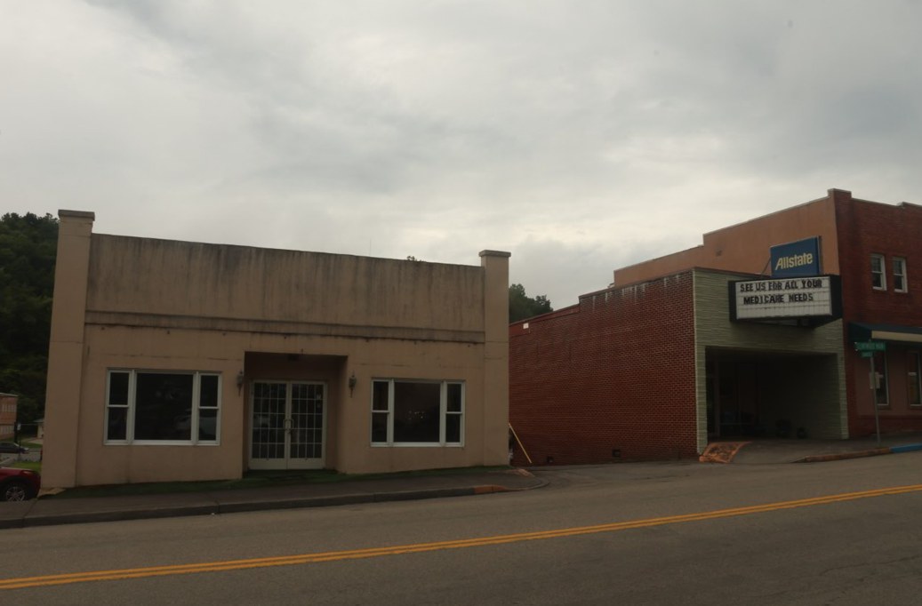
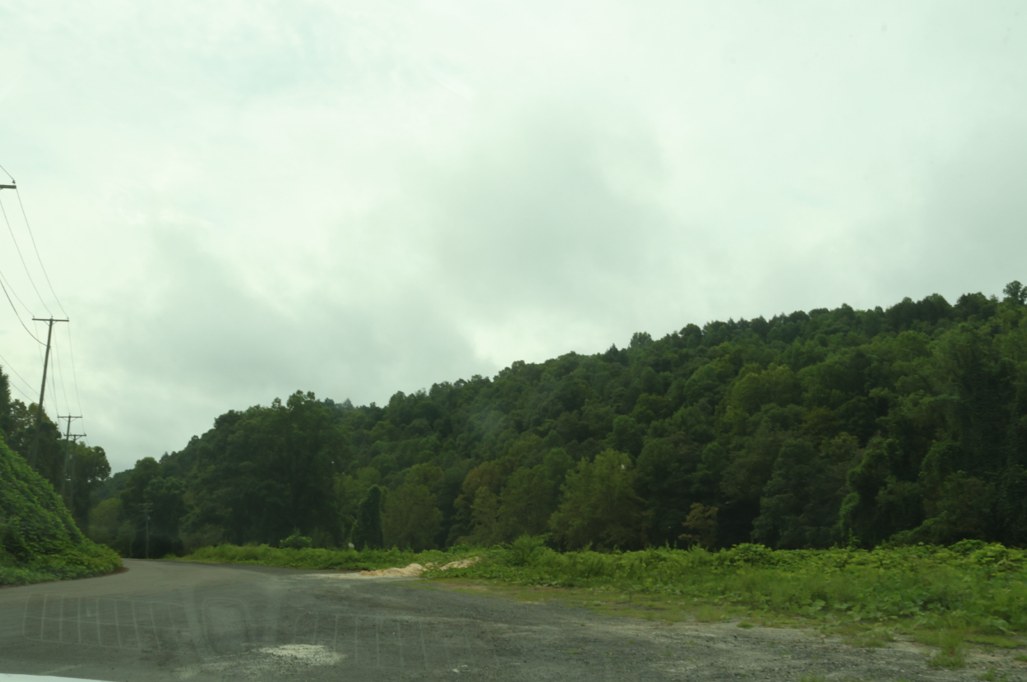
Additional field photographs
These instructor-provided photo albums offer additional context for the project area. Open them in a new tab.
Dickenson project reference materials
These earlier studies and examples are shared across all four Dickenson teams. Start with the material relevant to your site, then compare its assumptions and ideas with current evidence and the work the client has requested.
Open the shared Dickenson folder
Haysi and Clintwood site-development concept study
Structr Advisors' 2023 study examines the former Haysi High School site and the Green-Barnette site near Clintwood. It includes site context, possible uses, regional examples and development approaches.
Open the 2023 concept study (PDF)
The study's Clintwood site is not automatically the same as your assigned housing or downtown-reuse site. Confirm the location before applying its findings. Its conditions and assumptions reflect the earlier study.
Dickenson County floodplain-property playbook presentation
A December 2025 student presentation explores possible reuse of cleared parcels and ideas for downtown Haysi. Study how it organizes property types, alternatives and visual explanations.
Open the earlier presentation (PowerPoint)
These are earlier concepts, not adopted plans or confirmed development permissions. Verify current parcel restrictions, flood information, infrastructure and client priorities. It does not establish Red Onion's industrial-site readiness.
Labeled parcel-layout maps
Earlier maps show parcels labeled as county-owned around Haysi, Clinchco, Nora, McClure and Birchleaf. Card numbers can help you connect the mapped locations to parcel records.
Open the labeled parcel layouts (PDF)
Use the labels as research leads. Check current county GIS and property records; these sheets alone do not establish present title, boundaries, permitted uses or suitability.
Parcel-layout maps without card-number labels
The companion sheet, dated November 1, 2025, provides a clearer view of the earlier mapped parcel pattern, roads and waterways.
Open the companion parcel layouts (PDF)
Read it alongside the labeled sheet. Keep the source date visible, and do not treat the earlier mapping as an up-to-date survey or a substitute for your own analysis.
Use these as references, not as a replacement for your project work. They do not change your committed scope or assignment requirements. Keep source dates and credits when you refer to them.
Confirmed geography
Where the work is focused
- Downtown Clintwood buildingReuse site
37.1502292, -82.4559435 - Clintwood housing siteHousing site
37.1479101, -82.4615433
Loading confirmed project locations.
Community driving tour
Dickenson County driving tour: Clintwood to Haysi
This driving tour begins in Clintwood and continues to Haysi, providing visual context for the county's settlement pattern, transportation corridors, terrain, and community character. The route does not visit Red Onion Industrial Park.
Watch the GoPro tourProject purpose
Dickenson County asked for help connecting downtown reuse in Clintwood with a nearby housing opportunity. The team should study the identified downtown building and housing site, show realistic ways each could be used, and explain what the County, property owners, and partners would need to do next.
Scope of work
- Document the two sites, relevant buildings and parcels, access, ownership, infrastructure, housing context, and applicable policies using available information.
- Prepare practical reuse and housing layouts that show possible uses, unit or site relationships, parking, access, and connections to downtown Clintwood.
- Identify the partner conversations, due diligence, financing leads, phasing, and next decisions needed to advance the concepts.
Expected deliverables
- A concise site and housing context profile for the identified Clintwood locations
- Illustrated downtown reuse and housing concepts with clearly stated assumptions
- A preferred direction, next-step roadmap, financing and partnership leads, presentation, and editable graphics
Case studies and precedents
These examples can help you see different ways the work has been done. Treat them as starting points, not prescriptions. Check what is specific to each place and what still needs evidence for your project.
Clintwood, Virginia
Clintwood Main Street green-lot concepts
A 2023 Dickenson County update described an initial concept study that included a green lot on Main Street in Clintwood alongside a separate former-school site in Haysi.
What to study: Look at how site capacity, access, utilities, stakeholders, and traffic were framed as feasibility questions before design decisions.
Context: Confirm with the instructor or County whether the green lot is the same as the assigned housing location. The article is a 2023 status report, not proof of current site conditions.
Marion, Virginia
Upper-floor apartments over a downtown business
A feasibility study tested a second-floor addition above a downtown brewery, comparing apartments with other uses and reviewing code, market, parking, cost, and design questions.
What to study: Notice how alternatives and the evidence behind them help a property owner decide what to investigate next.
Context: Concepts and preliminary estimates are not a building approval or feasibility certification.
Pulaski, Virginia
Pulaski downtown reuse and housing
A small-town case shows commercial storefronts paired with upper-floor apartments and documents the planning, market, financing, and partnership steps behind the projects.
What to study: Compare the public role, property-owner actions, and funding sequence with the two separate Clintwood sites.
Context: The examples do not establish demand, ownership, costs, or feasibility in Clintwood.
Scope and review parameters
- The work is conceptual planning, not an architectural, engineering, appraisal, environmental, or market certification.
- A brownfield or environmental screen identifies documented conditions and further-review needs; it does not establish contamination or safety.
- Private-property concepts must be presented as opportunities requiring owner, regulatory, technical, and financial review.
Treat the list above as the client's full set of needs, not a promise that every item will be completed this semester. In the Work Plan, commit to approximately 50% of what the team is confident it can complete well by the final deadline. The committed scope must be approved by the instructor and client. Additional work may be completed if time allows. Every concept must identify its assumptions and the property-owner, regulatory, technical, or financial review still required.
Comparable places
Global Twins
These places face comparable terrain, settlement or economic challenges. Study the documented response, the conditions it depends on, and what differs here. A close analogy is a basis for analysis, not a design to copy or a claim about ancestral origin.
Explore the map and all comparisonsClintwood
A small mountain town serving a wider rural territory, with downtown reuse and housing work.
Europe
Sort
Pallars Sobirà, Catalonia · Spain
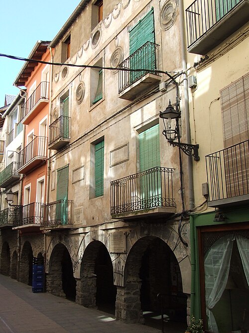
Mountain town in the Pyrenean Pallars Sobirà comarca, on the Noguera Pallaresa corridor; serves a dispersed high-mountain territory.
Population: 2,258 (municipality, 2024); village-only population not separately reported here
What happened here
Sobirà 20-30 is a territorial strategic plan jointly promoted by the Pallars Sobirà County Council and the Municipality of Sort, with participation by the comarca's other 14 municipalities; it is designed to prioritize implementable cross-municipal projects. The council also reports a 2026 50% IBI reduction for 56 homes entering social rent in Sort. The cited material documents a plan and a tax measure, not downstream housing or economic outcomes.
Why compare it with Clintwood?
A small mountain administrative and service centre for a much larger rural territory. This is a functional analogue, not a claim that the economies or governmental systems are alike.
- small incorporated town serving a rural hinterland
- mountain terrain shapes access and settlement
- regional public and commercial services concentrate in the centre
- town-scale land and infrastructure decisions affect a wider rural catchment
What students should study here
- Map regional services and travel catchments separately from municipal boundaries.
- Coordinate transport, utilities, and public facilities with surrounding rural jurisdictions.
- Protect a compact centre while recognizing terrain constraints on expansion.
What differs: Sort is the comarca capital in Catalonia and is embedded in Spanish regional and municipal structures; Clintwood is a Virginia town within Dickenson County. Sort's Pyrenean economy and cross-border European context are not proxies for Appalachian coal-transition conditions.
Virginia project contextSources and geographic scope
Checked September 30, 2026. Population figures retain their year and statistical boundary; a municipal total is not a village count. Locator points are approximate, not surveyed boundaries.
- Idescat municipal distribution, Pallars Sobirà 2024Statistical Institute of Catalonia (Idescat), based on INE Continuous Population Census
- Pallars Sobirà comarca portalConsell Comarcal del Pallars Sobirà
- Sobirà 20-30 Comarcal Strategic Plan
- Sort social-rental IBI measure
Sort: Approximate named-place locator, not a survey, parcel or settlement boundary. Coordinate source
Europe
Potes
Cantabria · Spain
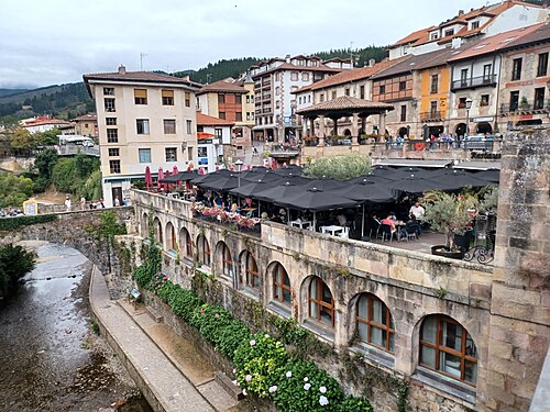
Mountain-valley town at the centre of the historic Liébana comarca, where rivers meet and steep mountain relief shapes access.
Population: 1,323 (municipality, 1 January 2025; official INE municipal register figure)
What happened here
Cantabria announced rehabilitation of the former La Serna schools in Potes as the future Escuela de Cocina y Gastronomía, with a professional training cycle intended for 2026-2027 and reported investment of about €1.5 million. The documented purpose is to extend hospitality training serving Liébana; the project was still being prepared/constructed in the cited 2026 announcement, so no enrollment or employment outcome is claimed.
Why compare it with Clintwood?
Potes is documented as a comarca service and attraction centre; its regional-service role makes it a useful comparator for Clintwood's rural service-hub question, but its tourism-oriented economy is a major distinction.
- small town serving a broad mountain hinterland
- mountain geography constrains access and development
- services and public facilities are concentrated in the town
- regional identity and local heritage support economic activity
What students should study here
- Assess service catchments beyond town limits before locating public facilities.
- Pair visitor-economy investments with year-round services and resident needs.
- Treat regional access and utility reliability as economic-development infrastructure.
What differs: Potes is described by Spanish tourism authorities as central to Liébana and by Spain's environment ministry as its service pole; tourism is prominent. Clintwood's comparison should focus on rural service centrality, not copy a tourism-led strategy.
Virginia project contextSources and geographic scope
Checked September 30, 2026. Population figures retain their year and statistical boundary; a municipal total is not a village count. Locator points are approximate, not surveyed boundaries.
- Potes tourism profileTURESPAÑA / Spain.info
- Picos de Europa Biosphere Reserve profileSpain Ministry for the Ecological Transition (MITECO)
- Cantabria tourism: PotesCantabria regional tourism portal
- INE Cantabria: population by municipality and sex, table 2893Instituto Nacional de Estadística (INE), distributed through the official data catalogue
- Potes Cocina y Gastronomía vocational cycle announcement
- Cantabria 2026-2027 education-centre assignment notice
Potes: Approximate named-place locator, not a survey, parcel or settlement boundary. Coordinate source
Europe
San Antolín de Ibias
Asturias · Spain
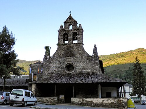
Remote mountain municipality with many small settlements; San Antolín is the municipal seat, in a landscape with extensive forest cover.
Population: Village population not separately reported in the cited current source; Ibias municipality population is not a substitute
What happened here
Ibias's 2022 Tourism Sustainability Plan/Cohesion Action is reported by the municipality as including a bridge upgrade on the El Bao–La Collada tourism path, safety improvements on the San Antolín tourism trail, route mapping/signage/marking across the concejo, and bicycle-repair facilities. The municipality lists project costs; this is evidence of named works and reported execution, not quantified visitor or business results.
Why compare it with Clintwood?
The strongest parallel is a small settlement functioning as an administrative/service centre within a dispersed rural mountain territory, with remoteness and weak communications explicitly identified by Ibias's municipality.
- small administrative centre serving a dispersed rural population
- mountainous terrain and difficult access
- public services and local administration concentrated in a central settlement
- economic development must address both town-centre needs and outlying communities
What students should study here
- Inventory service access by settlement rather than relying on municipality-wide averages.
- Coordinate road, communications, and service planning for remote communities.
- Design tourism and heritage actions as complements to everyday economic and public-service needs.
What differs: Ibias is a very dispersed Asturias municipality with 77 settlements and extensive forest land; Clintwood is a distinct incorporated town in a coalfield county. No village-level population is asserted.
Virginia project contextSources and geographic scope
Checked September 30, 2026. Population figures retain their year and statistical boundary; a municipal total is not a village count. Locator points are approximate, not surveyed boundaries.
- Population and economic structure of IbiasAyuntamiento de Ibias
- Municipal directoryAyuntamiento de Ibias
- Asturias population by parish layer (2024)Principality of Asturias statistical/geographic service
- Ayuntamiento de Ibias: ACD actions
- Principality of Asturias agreement/adenda for Ibias ACD 2022
San Antolín de Ibias: Approximate named-place locator, not a survey, parcel or settlement boundary. Coordinate source
Europe
Ax-les-Thermes
Ariège, Occitanie · France
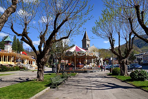
Pyrenean mountain town and central commune in Haute-Ariège; thermal-water heritage and mountain recreation shape its local economy.
Population: 1,285 (commune, 2023)
What happened here
The municipality's 2024 mid-term report documents a coordinated thermalism relaunch project presented by SEMTTAX and a €3.7 million recapitalization involving the municipality and public partners before the operating concession ended. This is a funded/relaunch effort, not evidence that visitor demand, revenue, or long-run viability targets were achieved.
Why compare it with Clintwood?
A small mountain town with a service-centre role and a place-specific economic asset; the useful planning comparison is how to connect the town's distinctive industry/amenity base to year-round community needs.
- small town in a mountain region
- central-place role within a wider rural area
- constrained geography affects circulation and development
- economic strategy must link local assets with services and infrastructure
What students should study here
- Treat the central business area and public realm as part of the service network, not just visitor scenery.
- Use place-specific assets to diversify rather than assume they can replace all legacy employment.
- Track resident population and seasonal/second-home effects as different measures.
What differs: Ax-les-Thermes is a thermal spa and mountain recreation destination, not a coal-transition analogue. INSEE reports 1,285 residents for the whole commune in 2023; 78.6% of dwellings were secondary/occasional residences, so seasonal pressure matters.
Virginia project contextSources and geographic scope
Checked September 30, 2026. Population figures retain their year and statistical boundary; a municipal total is not a village count. Locator points are approximate, not surveyed boundaries.
- INSEE territorial comparison, Ax-les-ThermesInstitut national de la statistique et des études économiques (INSEE)
- INSEE commune geographyINSEE
- Ax-les-Thermes municipal urban planning pageMairie d'Ax-les-Thermes
- Ax-les-Thermes local plan metadataGéoportail de l'Urbanisme
- Ax-les-Thermes municipal mid-term report
Ax-les-Thermes: Approximate named-place locator, not a survey, parcel or settlement boundary. Coordinate source
Europe
Pola de Somiedo (La Pola Somiedo)
Somiedo, Asturias · Spain
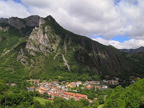
Small settlement in the Cantabrian Mountains, within Somiedo municipality and the Somiedo protected natural area; the town is the municipal seat.
Population: Village population not separately reported in the official source reviewed; Somiedo municipality population must not be assigned to Pola de Somiedo
What happened here
The Municipality of Somiedo initiated environmental review of a named visitor reception and tourism-flow management facility for the Natural Park in 2026. Separately, MITECO documents the operating all-year reception/interpretation centre in Pola, zoned visitor routes, and the park's European Charter for Sustainable Tourism accreditation. The new facility is a proposal under environmental assessment, not a completed project.
Why compare it with Clintwood?
A small settlement acting as the administrative centre for a low-density mountain municipality offers a bounded comparison about service concentration and balancing conservation with community viability.
- mountain settlement with a wider rural catchment
- administrative services concentrated in a small centre
- terrain and distance shape access to services
- local economic choices must account for landscape and community assets
What students should study here
- Map where municipal services are located and how remote residents reach them.
- Connect conservation and recreation management to local businesses and resident needs.
- Do not conflate a settlement's population with the municipality or protected-area population.
What differs: Somiedo's protected landscape and nature-based visitation differ from Clintwood's Appalachian coalfield and administrative context. Village-level population is not asserted; available municipal data cannot be substituted.
Virginia project contextSources and geographic scope
Checked September 30, 2026. Population figures retain their year and statistical boundary; a municipal total is not a village count. Locator points are approximate, not surveyed boundaries.
- Somiedo municipal e-officeAyuntamiento de Somiedo
- Asturias population by parish layer (2024)Principality of Asturias
- Asturias Environmental Bulletin: Somiedo visitor reception/flow project
- MITECO Biosphere Reserve: Somiedo use and tourism management
Pola de Somiedo: Approximate named-place locator, not a survey, parcel or settlement boundary. Coordinate source
U.S. Appalachia
Marlinton
Pocahontas County, West Virginia · United States
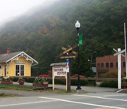
Small Allegheny/Appalachian mountain town on the Greenbrier River, serving as Pocahontas County's seat. The river corridor, surrounding uplands, rail-trail, and mapped flood hazards shape access, recreation, and land-use decisions.
Population: 998 (incorporated town, 2020 Census)
What happened here
The existing Greenbrier River Trail repurposes the former railroad corridor as a 78-mile state recreation trail with access at Marlinton. The town separately regulates floodplain development using FEMA mapping and local flood-hazard information. These are operating infrastructure and regulatory programs, not claimed economic outcomes.
Why compare it with Clintwood?
A small Appalachian county-seat town that concentrates civic and commercial services for a rural mountain county; this is a service-centre comparison, not a claim that Marlinton shares Clintwood's coal economy.
- small incorporated town and county-seat/service role
- mountainous rural county hinterland
- transport corridors helped shape historical town development
- outdoor assets can connect downtown services and local businesses
- flood exposure affects parts of the town and public infrastructure
What students should study here
- Connect downtown visitor and resident services to a continuous, well-signed trail access network.
- Use flood maps and local flood data to steer new facilities away from high-risk locations and protect critical services.
- Coordinate town and county investments because the service catchment extends beyond the municipal boundary.
- Treat recreation and heritage as diversification opportunities while maintaining year-round local services.
What differs: Marlinton's documented historic industries were timber and railroad, and its current recreation identity is closely tied to the Greenbrier River Trail. Clintwood is a Virginia coalfield county seat with a different industrial legacy. Marlinton's river flood risk is a central land-use constraint.
Virginia project contextSources and geographic scope
Checked September 30, 2026. Population figures retain their year and statistical boundary; a municipal total is not a village count. Locator points are approximate, not surveyed boundaries.
- State of West Virginia incorporated places, 2020 CensusU.S. Census Bureau TIGERweb
- Pocahontas County profileState of West Virginia
- Greenbrier River Trail, state park pageWest Virginia State Parks
- Marlinton floodplain regulationsTown of Marlinton municipal code
- Region 4 Hazard Mitigation Plan, Town of MarlintonRegion 4 Planning and Development Council and participating jurisdictions
- Marlinton historye-WV: The West Virginia Encyclopedia
Marlinton: Approximate named-place locator, not a survey, parcel or settlement boundary. Coordinate source
Canadian Appalachia
Saint-Quentin
Restigouche County, New Brunswick · Canada
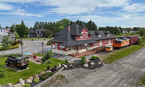
Saint-Quentin sits above 300 metres on a plateau in New Brunswick's Appalachian Uplands. The post-2023 municipality has a very large forest-and-farmland territory; the compact town centre remains a local service and business focus.
Population: 2,141 (2021 population centre / former town footprint; pre-2023 boundary). Saint-Quentin's current municipal website reports more than 3,645 residents but does not date that figure; neither is a current post-reform census count.
What happened here
Saint-Quentin lists a 2025-2029 strategic plan and an Integrated Drinking-Water Source Protection Plan for 2025-2035. New Brunswick's capital plan also lists 1.1 km of Rue Canada storm/sewer, curb/gutter and paving work; the published schedule does not show a funded year, so completion is not asserted.
Why compare it with Clintwood?
A small, French-speaking rural service centre in a forested Appalachian upland with an economy connected to natural-resource, agricultural, and local-service sectors. The lesson is about settlement and service geography, not an equivalent coalfield history.
- small town serving a broad rural hinterland
- Appalachian upland setting and constrained inter-town access
- forestry/agriculture and local services are part of the economy
- civic and commercial services concentrate in the town centre
- the municipal boundary includes or may include dispersed rural settlements
What students should study here
- Map the service catchment and settlement network rather than treating municipal land area as the service area.
- Pair forest and farm value-chain development with downtown services, workforce access, and community infrastructure.
- Phase land-use, service, and capital plans against the actual post-reform municipal boundary.
- Record census geography and municipal boundary dates on every population comparison.
What differs: New Brunswick's municipal amalgamation/annexation took effect 1 January 2023; the 2021 count is for the earlier, much smaller town/population-centre unit. The current municipal site gives an undated population statement. Saint-Quentin is strongly Francophone and its resource base differs from Clintwood's coal economy.
Virginia project contextSources and geographic scope
Checked September 30, 2026. Population figures retain their year and statistical boundary; a municipal total is not a village count. Locator points are approximate, not surveyed boundaries.
- Statistics Canada population and dwelling counts: population centresStatistics Canada
- Standard Geographical Classification 2021: Saint-QuentinStatistics Canada
- Regulation 2022-50, Local Governance Reform ActGovernment of New Brunswick
- Saint-Quentin official municipal siteVille de Saint-Quentin
- Saint-Quentin official plans and publicationsVille de Saint-Quentin
- Saint-Quentin public works and water protection
- New Brunswick The Road Ahead 2024 capital plan
Saint-Quentin: Approximate named-place locator, not a survey, parcel or settlement boundary. Coordinate source
Work from the confirmed scope.
Use the community conversation, instructor-provided project needs, and existing documents to keep your work aligned with the client. Confirm any scope change with Tyler before promising it to the community partner.
See all projects