Industrial Site Strategy, Website, and Marketing
Create an evidence-based positioning and communication package that presents Red Onion Industrial Park clearly to prospective businesses, site selectors, partners, and funders.
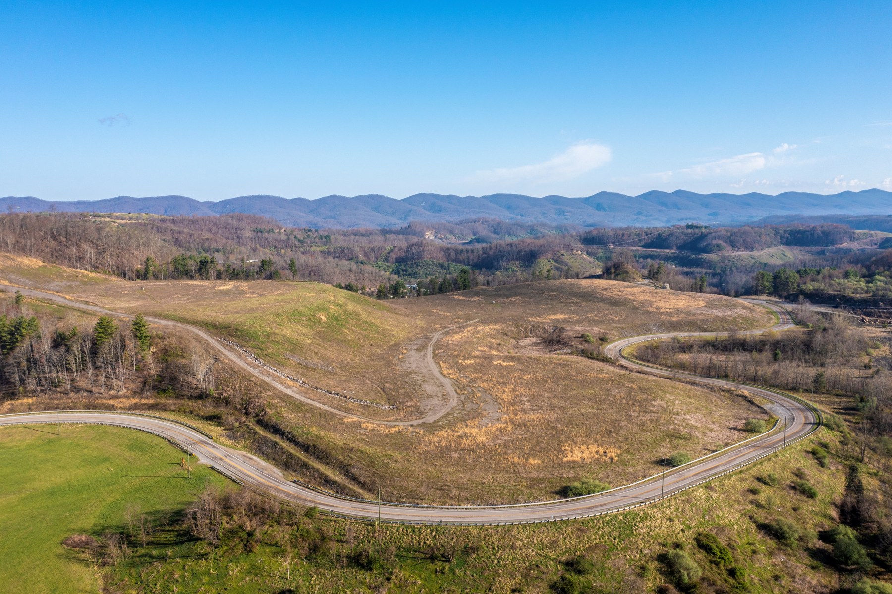
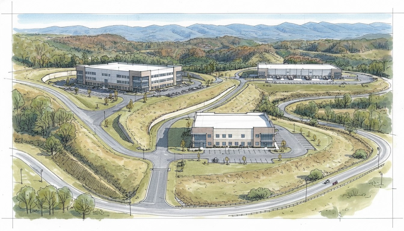
Additional field photographs
These instructor-provided photo albums offer additional context for the project area. Open them in a new tab.
Dickenson project reference materials
These earlier studies and examples are shared across all four Dickenson teams. Start with the material relevant to your site, then compare its assumptions and ideas with current evidence and the work the client has requested.
Open the shared Dickenson folder
Haysi and Clintwood site-development concept study
Structr Advisors' 2023 study examines the former Haysi High School site and the Green-Barnette site near Clintwood. It includes site context, possible uses, regional examples and development approaches.
Open the 2023 concept study (PDF)
The study's Clintwood site is not automatically the same as your assigned housing or downtown-reuse site. Confirm the location before applying its findings. Its conditions and assumptions reflect the earlier study.
Dickenson County floodplain-property playbook presentation
A December 2025 student presentation explores possible reuse of cleared parcels and ideas for downtown Haysi. Study how it organizes property types, alternatives and visual explanations.
Open the earlier presentation (PowerPoint)
These are earlier concepts, not adopted plans or confirmed development permissions. Verify current parcel restrictions, flood information, infrastructure and client priorities. It does not establish Red Onion's industrial-site readiness.
Labeled parcel-layout maps
Earlier maps show parcels labeled as county-owned around Haysi, Clinchco, Nora, McClure and Birchleaf. Card numbers can help you connect the mapped locations to parcel records.
Open the labeled parcel layouts (PDF)
Use the labels as research leads. Check current county GIS and property records; these sheets alone do not establish present title, boundaries, permitted uses or suitability.
Parcel-layout maps without card-number labels
The companion sheet, dated November 1, 2025, provides a clearer view of the earlier mapped parcel pattern, roads and waterways.
Open the companion parcel layouts (PDF)
Read it alongside the labeled sheet. Keep the source date visible, and do not treat the earlier mapping as an up-to-date survey or a substitute for your own analysis.
Use these as references, not as a replacement for your project work. They do not change your committed scope or assignment requirements. Keep source dates and credits when you refer to them.
Confirmed geography
Where the work is focused
- Red Onion Industrial ParkIndustrial site
37.1244822, -82.5355387
Loading confirmed project locations.
Community driving tour
Dickenson County driving tour: Clintwood to Haysi
This driving tour begins in Clintwood and continues to Haysi, providing visual context for the county's settlement pattern, transportation corridors, terrain, and community character. The route does not visit Red Onion Industrial Park and should be used only for broader county context.
Watch the GoPro tourProject purpose
Dickenson County asked the class to focus on Red Onion Industrial Park as its own project and pair the site work with a website and marketing package. The team should assemble verified information, explain the site clearly to prospective businesses and partners, and create materials the County can continue to use and update.
Scope of work
- Document the industrial park's property context, developable area, topography, transportation access, available utility information, environmental considerations, workforce context, nearby assets, and known follow-up needs.
- Identify the intended audiences and strongest supportable messages, then organize approved facts, sources, maps, photographs, and contacts for public communication.
- Prepare a maintainable website prototype and coordinated marketing materials that clearly distinguish confirmed conditions, planned improvements, and information still requiring verification.
Expected deliverables
- A verified industrial-site profile with maps and a claims-and-sources register
- A public-facing website prototype using approved site facts, images, resources, and contact information
- A concise marketing package, presentation, update instructions, and editable handoff files
Case studies and precedents
These examples can help you see different ways the work has been done. Treat them as starting points, not prescriptions. Check what is specific to each place and what still needs evidence for your project.
Norton, Virginia
Intersection Business and Industry Park
A nearby former-mine site moved from site preparation and regional partnership to company recruitment and an opened manufacturing facility.
What to study: Compare the site's public information, recruitment partners, project announcement, workforce details, and transition from a potential site to an operating tenant.
Context: Norton's acreage, utilities, incentives, tenants, and job figures are not Red Onion facts.
Virginia
Virginia Business Ready Sites Program
VEDP's site pages show how available properties communicate acreage, control, access, utilities, workforce connections, readiness, and a contact path to site selectors.
What to study: Use its information structure to audit whether a prospect can answer basic questions from the page and find the next step.
Context: Do not label Red Onion certified or assign it a readiness tier without client-confirmed program records.
Southwest Virginia
VCEDA digital business-attraction campaign
A vendor case describes using a regional development authority's website and digital outreach to reach target-industry prospects and track engagement.
What to study: Think about a website as part of a recruitment path: useful site facts, clear inquiry steps, and measures that show whether the intended audience responds.
Context: The reported outcomes are the consultant's own account, not an independent evaluation.
Scope and review parameters
- Every public fact, property statement, utility claim, incentive reference, and image must be verified and approved for its intended use.
- The work may explain readiness and remaining actions, but it may not imply engineering certification, guaranteed capacity, property control, incentive commitments, or a development approval.
- The website and marketing system must remain editable and maintainable by the responsible local or regional partner.
Treat the list above as the client's full set of needs, not a promise that every item will be completed this semester. In the Work Plan, commit to approximately 50% of what the team is confident it can complete well by the final deadline. The committed scope must be approved by the instructor and client. Additional work may be completed if time allows. Credibility is essential: public materials must distinguish confirmed assets, planned improvements, and unresolved questions.
Comparable places
Industrial Park Twins
These places face comparable terrain, settlement or economic challenges. Study the documented response, the conditions it depends on, and what differs here. A close analogy is a basis for analysis, not a design to copy or a claim about ancestral origin.
Explore the map and all comparisonsThe site is not the same as the usable land.
Compare how reclaimed land becomes individual platforms that a business can reach and use.
Oakdale: four development plateaus
- Plateau 1
- Plateau 2
- Plateau 3
- Plateau 4
Estate envelope: 400 acres / 162 ha.
Development plateaus: 170 acres / 69 ha in total.
Red Onion: three planned graded pads
- Pad 1
- Pad 2
- Pad 3
Site envelope: 99.4 acres / 40.2 ha.
Planned marketable pads: 30 acres / 12.1 ha in total.
Reported individual-pad range: 5–15 acres / 2–6.1 ha.
Symbols count platforms only. They do not represent their size, shape, location or completion status. Red Onion figures describe the planned fully developed site, not a claim that all pads are ready today.
Study: What connects the platforms? What land is needed for slopes, drainage, utilities and access? How does the prospect information distinguish the whole site from a usable pad?
Red Onion Industrial Park
A reclaimed mine-land industrial site requiring credible pad, access, utility and recruitment evidence.
Industrial Park Twin
Oakdale Business Park
Caerphilly County Borough, South Wales · United Kingdom
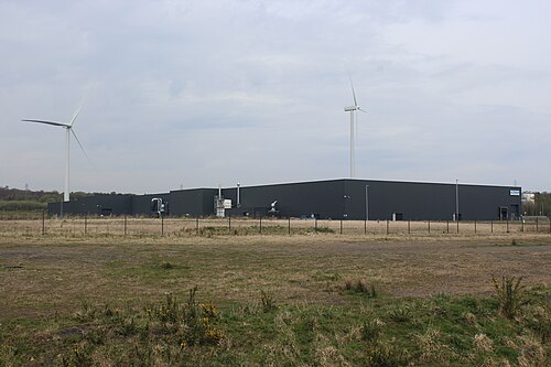
Recontoured former colliery land in the South Wales valleys, with development concentrated on four engineered plateaus and linked by a spine road and cross-valley access infrastructure.
What happened here
The former colliery was reclaimed and organized into four development plateaus, linked by a spine road and dedicated cross-valley access. Study the relationship between usable platforms, circulation and landscape treatment; the historical reclamation budget is not a current project-cost estimate.
Why compare it with Red Onion Industrial Park?
The clearest engineering-and-delivery comparison: reclaimed mine land, large engineered pads and public access investment used to create a marketable industrial land product.
- former mining land reclaimed for employment
- engineered flat development areas within valley terrain
- public grading, roads and utilities precede business recruitment
- landscape and access connect separated development areas
What students should study here
- Separate the reclaimed envelope from saleable plateau area.
- Relate the access programme to the order in which pads can be marketed.
- Use design guidance to connect roads, landscape and individual business plots.
- Compare the four-plateau delivery model with Red Onion's three-pad 2025 programme.
- Distinguish historic investment, current plot readiness and actual tenant demand.
What differs: Oakdale's advertised estate envelope is much larger. Welsh planning and historical European funding are not U.S. programmes. Its older marketing pages do not establish current vacancy, transport frequencies or construction costs.
Virginia project contextIndustrial land, infrastructure and delivery
- Area and boundary
- 400 acres / about 162 ha reclaimed estate envelope; 170 acres / about 69 ha of development plateaus, as reported by the council-linked park website.
- Former land use
- Oakdale Colliery; reclaimed former mining land.
- Terrain
- Four recontoured development plateaus, with intervening landscape and valley access constraints.
- Pads / phases
- Four plateaus. Advertised development-plateau area is not the full 400-acre estate.
- Infrastructure
- Spine road, entrance roundabout and connections to the adjacent industrial estate; council design brief for layout and landscape.
- Access strategy
- Sirhowy Enterprise Way and two cross-valley links; the park account dates completion to December 2005.
- Business mix
- Business, industrial and storage development framework; General Dynamics documents an Oakdale operation in a 2025-issued certificate.
- Public investment
- Park website reports six years and more than GBP 10 million for reclamation. Historical funding and road-finance arrangements are not 2026 costs.
- Development status
- Existing business park with developed units and land marketed by the council. Confirm current availability directly; older marketing descriptions are not a live inventory.
- Key lesson for Red Onion
- Market a connected, phased industrial system, not isolated flat pads. Pair reclamation with credible access, utility and design evidence.
Sources and geographic scope
Checked September 30, 2026. Population figures retain their year and statistical boundary; a municipal total is not a village count. Locator points are approximate, not surveyed boundaries.
- Oakdale land and four-plateau conceptCaerphilly County Borough Council-linked business park site
- Oakdale reclamation historyCouncil-linked park marketing site
- Access and spine-road strategyCouncil-linked park marketing site
- General Dynamics Oakdale operations certificateGeneral Dynamics UK / BSI
Oakdale Business Park: Approximate named-place locator, not a survey, parcel or settlement boundary. Coordinate source
Industrial Park Twin
La Curiscada Industrial Estate
Tineo, Asturias · Spain
A rural employment area beside the AS-216 near El Crucero, about 4 km / 2.5 miles from Tineo. Its land programme separates business plots, roads, facilities and green areas.
What happened here
Tineo developed the industrial estate in successive phases, with later phases supported by mining-region transition funding. The regional inventory documents serviced land and an industrial business mix; the broader municipal estate and Sector 1 have different reported boundaries.
Why compare it with Red Onion Industrial Park?
A close rural industrial-delivery comparison for phased land preparation, mining-transition funding and a business mix rooted in the surrounding working countryside.
- rural industrial recruitment outside a town centre
- public preparation of serviced business plots
- phased development and infrastructure spending
- economic diversification in a former mining region
What students should study here
- Match parcel sizes to local food, forestry, equipment and service businesses.
- Distinguish gross estate area from saleable industrial land.
- Trace how three phases and segregated subphases were funded and delivered.
- Combine business support with utilities and transport access.
- Use a maintained business directory and parcel inventory as marketing evidence.
What differs: The reviewed sources describe municipal land and mining-region funding, not a reclaimed mine at the estate itself. AS-216 frontage and the local food/forestry economy differ from Red Onion's engineered mine-land setting.
Virginia project contextIndustrial land, infrastructure and delivery
- Area and boundary
- 33.9241 ha / about 83.8 acres for Sector 1 in the regional inventory. The municipality describes the broader estate as more than 35 ha / 86.5 acres; these are not identical boundaries.
- Former land use
- Municipal land in a 1990 partial-plan programme; former mine-land use is not established by the source.
- Terrain
- Road-oriented rural site near Tineo; do not assume Red Onion's pad grades or geotechnical conditions.
- Pads / phases
- Three development phases, with Phase II split into two subphases; phases are not a verified count of engineered plateaus.
- Infrastructure
- Water, sewer, electricity and telecommunications; business-promotion centre, streets, green areas and hydrants.
- Access strategy
- AS-216. Inventory places it about 4 km / 2.5 miles from Tineo and 64 km / 39.8 miles from Oviedo.
- Business mix
- Regional inventory emphasizes food production, services, forestry, metalwork and wood products.
- Public investment
- Phase I involved SOGEPSA; later phases used mining-region reactivation funds. Source chronology identifies works in 1993, 2003, 2009 and 2010.
- Development status
- Existing phased estate. Municipal profile reports about 70 businesses, without a clearly stated census date. Regional inventory includes plots offered for sale; confirm current availability.
- Key lesson for Red Onion
- Design the land product around real rural business demand and phase it with utilities, access and business support.
Sources and geographic scope
Checked September 30, 2026. Population figures retain their year and statistical boundary; a municipal total is not a village count. Locator points are approximate, not surveyed boundaries.
- Regional estate inventory: La Curiscada Sector 1SEKUENS, Principality of Asturias
- Tineo municipal industrial-estate profileAyuntamiento de Tineo
- Estate business associationLa Curiscada business association
La Curiscada Sector 1: Regional industrial-estate inventory locator; not a surveyed parcel or the estate boundary. Coordinate source
Industrial Park Twin
Riaño II and III Industrial Estates
Langreo, Asturias · Spain
Industrial land in the Nalón valley: the river separates Riaño II from Riaño I, and a railway separates the Riaño III development from the earlier estate.
What happened here
SOGEPSA and Langreo developed industrial land in successive phases within the coal-region economy. River and railway corridors separate parts of the estates, making access and utility provision an essential part of parcel development rather than an afterthought.
Why compare it with Red Onion Industrial Park?
A useful post-coal land-delivery twin: public agencies and a municipality phased industrial infrastructure within an established mining-region economy.
- public industrial-land preparation
- mining-region economic diversification
- phased plots and infrastructure
- river and transport corridors shape the land product
What students should study here
- Separate industrial phase boundaries from river and rail barriers.
- Compare agency-led and municipality-led delivery responsibilities.
- Relate plot subdivision to a documented business mix.
- Include shared utilities, streets, maintenance and business information in the marketing package.
- Treat a completed phase and a currently available plot as different claims.
What differs: These are valley-floor estates in a larger urban-industrial corridor, not verified reclaimed mine plateaus. Their established regional business network and agency structure differ from Red Onion.
Virginia project contextIndustrial land, infrastructure and delivery
- Area and boundary
- 32.284 ha / about 79.8 acres gross, regional inventory. Riaño II is 25.2738 ha; two Riaño III phases add about 7.01 ha.
- Former land use
- Industrial expansion within a former coal-region economy; the reviewed inventory does not establish prior mine use for all parcels.
- Terrain
- Nalón valley floor, with river and railway barriers separating development areas.
- Pads / phases
- Riaño II plus two stages of Riaño III; these are industrial phases, not a stated plateau count.
- Infrastructure
- Municipal water and separate stormwater/wastewater systems; electricity, gas, telecommunications, public lighting and waste services.
- Access strategy
- AS-245; regional inventory locates it about 23 km / 14.3 miles from Oviedo.
- Business mix
- Regional inventory emphasizes metal-mechanical activity, civil engineering, trade and environmental services.
- Public investment
- SOGEPSA delivered Riaño II; Langreo municipality promoted Riaño III with mining-reactivation programmes.
- Development status
- Inventory lists the phases as existing. Plot availability remains a dated marketing question; do not infer vacancy or economic performance from completion alone.
- Key lesson for Red Onion
- Make public delivery, plot design, access and ongoing estate services part of the industrial strategy, not just the grading diagram.
Sources and geographic scope
Checked September 30, 2026. Population figures retain their year and statistical boundary; a municipal total is not a village count. Locator points are approximate, not surveyed boundaries.
- Regional inventory: Riaño II and IIISEKUENS, Principality of Asturias
- Riaño II project recordSOGEPSA
- Industrial-estate collective managementIDEPA / Asturias economic-development agency
Riaño II and III: Regional industrial-estate inventory locator; not a surveyed parcel or the estate boundary. Coordinate source
Industrial Park Twin
Argame Business Park
Morcín, Asturias · Spain
An industrial estate on both sides of the Caudal River, separated from Argame village by the N-630 and a FEVE railway corridor.
What happened here
Argame was planned and urbanized through a mining-region diversification programme, with a dedicated highway junction and documented green-space provision. Its river, road and railway setting illustrates how industrial land and environmental infrastructure must be designed together.
Why compare it with Red Onion Industrial Park?
An infrastructure-and-land-balance analogue: a mining-region industrial programme had to coordinate developable plots, river crossings, highway access, services and substantial green areas.
- economic diversification in a mining region
- publicly prepared industrial land
- access infrastructure shapes marketability
- development parcels must coexist with environmental and transport constraints
What students should study here
- Draw river, road and rail constraints before subdividing industrial land.
- Show the access works required to make a plot usable.
- Distinguish gross estate area, industrial plots, streets and green-space allocations.
- Align utility and drainage responsibilities with the phase programme.
- Explain environmental and access constraints honestly in recruitment material.
What differs: Argame is a valley-floor river/highway/rail site, not an established reclaimed mine plateau. Source mining-transition funding does not prove that the land itself was formerly mined.
Virginia project contextIndustrial land, infrastructure and delivery
- Area and boundary
- 30.2855 ha / about 74.8 acres gross; inventory allocates 6.2546 ha / about 15.5 acres to green areas.
- Former land use
- Industrial designation in 1998 and partial plan in 2002; earlier mine use is not established.
- Terrain
- Caudal River corridor with highway, railway and village edges.
- Pads / phases
- Single estate phase in the inventory; individual plots are listed, but no engineered-plateau count is given.
- Infrastructure
- Municipal water and wastewater; separate stormwater collection; industrial street network and green-space allocations.
- Access strategy
- N-630; the 2002 partial plan incorporated a required double-roundabout access. Access works followed in 2005.
- Business mix
- Inventory includes trade/rental, food industry, technology, metalwork, construction and logistics.
- Public investment
- Mining-reactivation funds financed the access programme; urbanization occurred in 2006–2007.
- Development status
- Existing estate with a public parcel inventory. Reconfirm availability and commercial terms with the promoter rather than relying on undated inventory rows.
- Key lesson for Red Onion
- The marketable industrial product is the plot plus access, drainage and utility connections, not the plot polygon alone.
Sources and geographic scope
Checked September 30, 2026. Population figures retain their year and statistical boundary; a municipal total is not a village count. Locator points are approximate, not surveyed boundaries.
- Regional inventory: ArgameSEKUENS, Principality of Asturias
- Morcín municipal authorityAyuntamiento de Morcin
Argame industrial estate: Regional industrial-estate inventory locator; not a surveyed parcel or the estate boundary. Coordinate source
Industrial Park Twin
Rassau Industrial Estate
Ebbw Vale, Blaenau Gwent, South Wales · United Kingdom
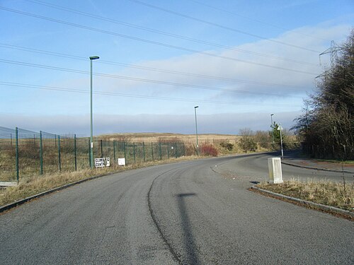
A large employment site north of Ebbw Vale in the Heads of the Valleys area, connected to the A465 corridor and the regional manufacturing economy.
What happened here
Rassau forms part of the Ebbw Vale Enterprise Zone strategy, which supports industrial recruitment and manufacturing. The published land-area inventory and historical expansion record establish scale and development history, not the amount of land available today.
Why compare it with Red Onion Industrial Park?
A regional industrial-strategy analogue for large employment land, transport investment, manufacturing recruitment and workforce coordination in a former coal-and-steel economy.
- post-extractive regional diversification mission
- industrial land supported by public planning and infrastructure
- large sites intended for manufacturing investment
- transport and workforce conditions shape recruitment
What students should study here
- Compare gross site boundaries with separately marketed development platforms.
- Link industrial recruitment to skills and regional transport investment.
- Distinguish approved factory proposals from operating businesses.
- Set out landscape buffers and net developable land in site marketing.
- Treat an enterprise-zone designation as one policy tool, not proof of demand.
What differs: Rassau is part of a much larger established manufacturing system. A 1976 parliamentary record describes an expansion on common land, not former mine land; the whole estate's prior use must not be generalized from that record.
Virginia project contextIndustrial land, infrastructure and delivery
- Area and boundary
- 113 ha / about 279 acres in the Welsh Government's 2019 major-employment-site inventory; this is a dated estate boundary, not a current vacant-land total.
- Former land use
- 1976 Rassau North expansion involved enclosure of 234 acres of common land; reviewed sources do not establish mine-land reclamation across the entire estate.
- Terrain
- Heads of the Valleys upland industrial setting; individual platforms and buffers are separate development units.
- Pads / phases
- Council planning documents identify named development platforms; a complete current estate-wide pad count is not reported in the reviewed sources.
- Infrastructure
- Prepared employment sites, roads and utilities within the wider Ebbw Vale enterprise-zone programme.
- Access strategy
- A465 Heads of the Valleys corridor; verify current transport services rather than quoting older brochures.
- Business mix
- Advanced-manufacturing recruitment within the Ebbw Vale enterprise zone; individual proposed projects require separate status checks.
- Public investment
- Government/council enterprise-zone and regional transport/skills support. Programme-wide budgets are not attributed to this estate alone.
- Development status
- Existing estate named in the current official enterprise-zone description. Older platform-area and vacancy figures are dated, not asserted as 2026 availability.
- Key lesson for Red Onion
- Connect industrial land to a regional skills-and-transport strategy, while reporting readiness and actual occupier status separately.
Sources and geographic scope
Checked September 30, 2026. Population figures retain their year and statistical boundary; a municipal total is not a village count. Locator points are approximate, not surveyed boundaries.
- Welsh Government employment-site inventoryWelsh Government, 2019
- Ebbw Vale enterprise-zone strategyBusiness Wales / Welsh Government
- Rassau North land assembly, 1976UK Parliament Hansard
- Development-platform and buffer exampleBlaenau Gwent County Borough Council
Rassau Industrial Estate: Approximate named-place locator, not a survey, parcel or settlement boundary. Coordinate source
Industrial Park Twin
Southern Gap Industrial Park
Buchanan County, Virginia · United States
Reclaimed coal-mined mountain land in Buchanan County's Appalachian Plateau. The wider Southern Gap development includes graded, developable areas within a rugged upland landscape; individual usable parcels and pads are much smaller than the controlled development boundary.
What happened here
The IDA's Southern Gap development has an operating tenant mix, while public agencies continue phase-specific work: VCEDA's 2023 annual report records an up-to-$2.5 million grant for a 20-acre Phase II industrial site; VCEDA later closed $1.6 million in separate 2025 grants for proposed commercial, housing and 130-acre mixed-use projects. These approvals do not establish that the new phases are complete or that projected jobs were realized.
Why compare it with Red Onion Industrial Park?
A Virginia coalfield industrial-site precedent relevant to the Red Onion comparison because it documents how an IDA has phased reclaimed mine land, utilities, access, shell space, and public grants. The comparison does not assume that Red Onion shares Southern Gap's acreage, terrain, readiness, or tenant mix.
- Appalachian coalfield context and legacy mined-land considerations
- site readiness requires parcel-specific grading and utility work
- industrial development is phased rather than one uniform ready site
- local development authority and regional funder coordinate investment
- transport access and marketable pad size affect prospect readiness
What students should study here
- Maintain a parcel-level site inventory that distinguishes controlled gross acreage from ready-to-build lots.
- Document utility capacities, last-mile access, grading, and substation dependencies for each phase.
- Use public funds for defined enabling infrastructure and report grant approval, closure, construction, and completion as different statuses.
- Keep mixed-use housing/commercial phases separate from industrial acreage and jobs reporting.
What differs: Southern Gap is a multi-use redevelopment on a broader 3,153-acre IDA-controlled reclaimed-mined-land area. The specific Red Onion Virginia reference is retained as the requested comparison ID; no unverified acreage or site condition is assigned to it.
Virginia project contextIndustrial land, infrastructure and delivery
- Area and boundary
- VCEDA reports 3,153 acres (1,276.3 ha) controlled by Buchanan County IDA for the broader Southern Gap development. A separate regional inventory reports approximately 3,000 gross industrial-park acres, 1,100 available acres, and a 40-acre largest contiguous parcel; these are different scopes and inventory measures, not a single buildable-area total.
- Former land use
- Previously surface-mined/reclaimed coalfield land; official project documents describe Southern Gap as developed on previously mined lands.
- Terrain
- Appalachian Plateau upland setting; the current site inventory describes flat grading within developable acres. This does not mean the entire controlled acreage is flat or build-ready.
- Pads / phases
- No verified count of completed pads located. VCEDA's 2023 annual report identifies an approximately 20-acre Phase II industrial site and a roughly five-acre site for a proposed shell building; 2025 funding closed for a proposed 130-acre mixed-use project in Phase II. These are project areas, not numbers of ready pads.
- Infrastructure
- Regional inventory lists three-phase power, recently added fiber, natural gas, and Buchanan County PSA water/sewer lines; reported available capacities are 600,000 gallons/day water and 1,000,000 gallons/day sewer. The inventory notes the electric substation/transmission lines are offsite and identifies potential traffic issues.
- Access strategy
- State Route 744 and the U.S. 460/U.S. 121 Corridor Q connection. VDOT reported approximately 12 miles of Corridor Q open with remaining two miles scheduled for later construction; VCEDA's 2023 report recorded the 8.7-mile section from Breaks Park Road to Southern Gap opening in 2023.
- Business mix
- Documented uses include Virginia Employment Commission customer-service call center, Paul's Fan Company, Southern Gap Transportation and Logistics Center (operated by Southwest Virginia Community College), Southern Gap Outdoor Adventure, and Appalachian Power's Buchanan County office. A 2025 mixed-use proposal adds commercial, residential, and industrial components; it is a proposed phase, not a completed tenant mix.
- Public investment
- VCEDA approved up to $2.5 million in 2023 for an approximately 20-acre Phase II industrial site. In October 2025, VCEDA closed three grants totaling $1.6 million for separate Phase II/site-development projects, including a proposed 130-acre mixed-use development. Virginia's AMLER program also awarded $1.95 million in 2022 for an approximately 16,000-square-foot Southern Gap Regional Office Park shell building. These are distinct awards and project scopes; do not aggregate them as one park cost or assign regional Corridor Q totals to park acreage.
- Development status
- Active, multi-use development with existing tenants. Specific Phase II site and shell-building projects are in development; VCEDA's 2025 grant announcement says the 130-acre mixed-use and commercial/housing components are proposed projects. The park's remaining available area and pad-readiness should be reverified before any site-specific claim.
- Key lesson for Red Onion
- Publish separate, date-stamped measures for IDA-controlled land, gross industrial-park area, available acreage, contiguous parcels, graded pads, and funded phase projects. Reclaimed-land readiness depends on parcel-specific grading, utility capacity, access, and continuing public investment; regional development totals are not a proxy for park acreage or delivered jobs.
Sources and geographic scope
Checked September 30, 2026. Population figures retain their year and statistical boundary; a municipal total is not a village count. Locator points are approximate, not surveyed boundaries.
- VCEDA 2023 Annual ReportVirginia Coalfield Economic Development Authority, reported through Virginia General Assembly legislative review
- Cumberland Plateau PDC Roadmap to Economic ResiliencyCumberland Plateau Planning District Commission
- VCEDA 2025 Southern Gap grantsVirginia Coalfield Economic Development Authority
- Virginia AMLER project list: Southern Gap Office Park BuildingVirginia Department of Energy, Mined Land Repurposing / AMLER program
- VDOT Corridor Q statusVirginia Department of Transportation
- Virginia AMLER previously mined lands project application, Southern GapVirginia Department of Energy / Buchanan County IDA application
Southern Gap Industrial Park: Approximate Ovenbird Road locator, serving the Southern Gap Center at 1102 Ovenbird Road; not the full development or a specific vacant pad. Address: https://www.sw.edu/about/locations.html Coordinate source
Industrial Park Twin
Harbourside Commercial Park
Sydney, Cape Breton Regional Municipality, Nova Scotia · Canada
Former Sydney Steel waterfront industrial land in urban Sydney, beside Sydney Harbour. Current site information describes mostly flat, cleared land, nearby deep-water port access, and available parcels. This is not a steep mining plateau or a topographic match for an upland Appalachian industrial park.
What happened here
Nova Scotia Lands and Harbourside phased Sydney Steel reclamation into serviced, transferred commercial land: the province reported 28.8 ha released after the first remediation phase in 2007, and Nova Scotia Lands reported 75 ha serviced and transferred in phases by 2013. The province's 2019-2020 plan still described long-term monitoring and additional cleanup needs on some remaining/adjacent areas. This is phased brownfield reuse, not a completed blanket cleanup claim or a topographic match to a mine plateau.
Why compare it with Red Onion Industrial Park?
A useful economic and infrastructure comparator for the Red Onion industrial-land question: Harbourside demonstrates reuse of a major legacy industrial property through phased remediation, public infrastructure, and commercial/industrial land management. The comparison is not topographic; the Sydney site is a flat reclaimed waterfront steel property, not a steep mine plateau.
- legacy industrial land requires environmental and infrastructure work before reuse
- public agencies and land-management entities coordinate remediation and redevelopment
- site readiness varies by parcel and phase
- commercial/industrial reuse can diversify employment after a major legacy employer closes
What students should study here
- Maintain distinct maps for original industrial property, park boundary, remediated phase, and currently available parcel.
- Coordinate the land steward, regulator, infrastructure operator, and park marketer with explicit transfer conditions.
- Tie public investment claims to the specific parcel and work item rather than the whole regional cleanup program.
- Publish service status and remaining environmental monitoring obligations before marketing a parcel as ready.
What differs: Harbourside is a flat urban waterfront steel-mill reclamation project with non-operational rail infrastructure and nearby deep-water port access. It does not match the Red Onion reference's Appalachian plateau setting. Its relevance is legacy-site reuse, governance, and phased readiness only.
Virginia project contextIndustrial land, infrastructure and delivery
- Area and boundary
- 121 ha (300 acres) reported for Harbourside Commercial Park in 2007. The larger former SYSCO property/remediation boundary is separately reported as about 182-185 ha (450 acres); these boundaries are not interchangeable and neither figure means all land is currently buildable.
- Former land use
- Sydney Steel Corporation steelworks, adjacent DEVCO coke ovens and Sydney Tar Ponds/Coke Ovens remediation lands; park area and cleanup project areas overlap but are not identical.
- Terrain
- Mostly flat and cleared former waterfront industrial land according to the current site profile; do not describe it as steep, mountainous, or mined-plateau terrain.
- Pads / phases
- Current site profile lists varied cleared parcels ready for construction but gives no pad count or consolidated buildable-acre total. A 2007 announcement reported 28.8 ha made available in phase one; a 2013 provincial business plan described 75 ha serviced and transferred in phases. These are dated phased handovers, not a current pad inventory.
- Infrastructure
- Current site profile reports three-phase power, paved/gravel internal roads, municipal water and sewer, highway access, sewer/culvert drainage, nearby deep-water port access, and rail infrastructure present but non-operational. Verify parcel-specific service connections before calling an individual lot ready.
- Access strategy
- Public-road access to a nearby provincial highway and close to Sydney's deep-water harbour/port; former rail infrastructure is present but currently non-operational according to the site profile.
- Business mix
- Heavy industrial and commercial park, with lots suitable for manufacturing and processing. Historical 2007 opening announcement reported 15 tenants and included a manufacturing example; the current bioeconomy-site profile lists co-location/industrial byproduct opportunities but does not provide a complete current tenant roster.
- Public investment
- Nova Scotia provided $10 million through the Industrial Expansion Fund to acquire Sysco land/buildings and develop/market the park (2007 announcement). Separate federal-provincial Sydney Tar Ponds/Coke Ovens remediation program was budgeted at $400 million; its 2012 release cited up to $17 million for park/green-space construction contracts. Do not attribute the full regional cleanup budget to Harbourside park acreage or industrial-site investment. Nova Scotia Lands continued long-term monitoring and remediation work after phased handovers.
- Development status
- Operating Crown-owned commercial/industrial park with cleared parcels marketed for manufacturing and processing. Former SYSCO properties have been remediated in phases; long-term monitoring and site-specific remediation continued for some adjacent/remaining areas in later provincial reports. Current parcel inventory and exact remediation status require parcel-level confirmation.
- Key lesson for Red Onion
- Treat brownfield redevelopment as a boundary-and-phase problem: distinguish park land from the larger contaminated industrial property, publish parcel-by-parcel remediation and service status, coordinate Crown land stewardship with the park operator, and keep cleanup budgets separate from park development costs. Its transferable lesson is economic/infrastructure reuse, not terrain similarity to a Virginia mine plateau.
Sources and geographic scope
Checked September 30, 2026. Population figures retain their year and statistical boundary; a municipal total is not a village count. Locator points are approximate, not surveyed boundaries.
- Harbourside Commercial Park current site profileNova Scotia Bioeconomy Sites, provincial site-development platform; Nova Scotia Lands site owner/manager cited
- Nova Scotia: Park Brings New Economic Opportunities to Cape BretonGovernment of Nova Scotia
- Nova Scotia Lands 2013-2014 Crown Corporation Business PlanNova Scotia Lands Inc. / Government of Nova Scotia
- Former Sites of Tar Ponds and Coke Ovens to be Park, Green SpaceGovernment of Nova Scotia and Government of Canada announcement
- Nova Scotia Lands Inc. Accountability Report 2018-2019Nova Scotia Lands Inc. / Harbourside Commercial Park Inc.
- Nova Scotia Lands 2019-2020 business plan
Harbourside Commercial Park: Harbourside Place at 45 Wabana Court: an administrative/address locator, not the full industrial park boundary. Coordinate source
Work from the confirmed scope.
Use the community conversation, instructor-provided project needs, and existing documents to keep your work aligned with the client. Confirm any scope change with Tyler before promising it to the community partner.
See all projects