Workforce Hub and Former-School Reuse
Develop coordinated reuse and operating strategies for former-school sites in Clinchco and Nora, connecting the facilities to workforce programs, users, partners, access, capital needs, and long-term stewardship.
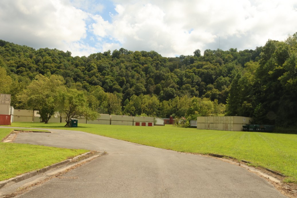
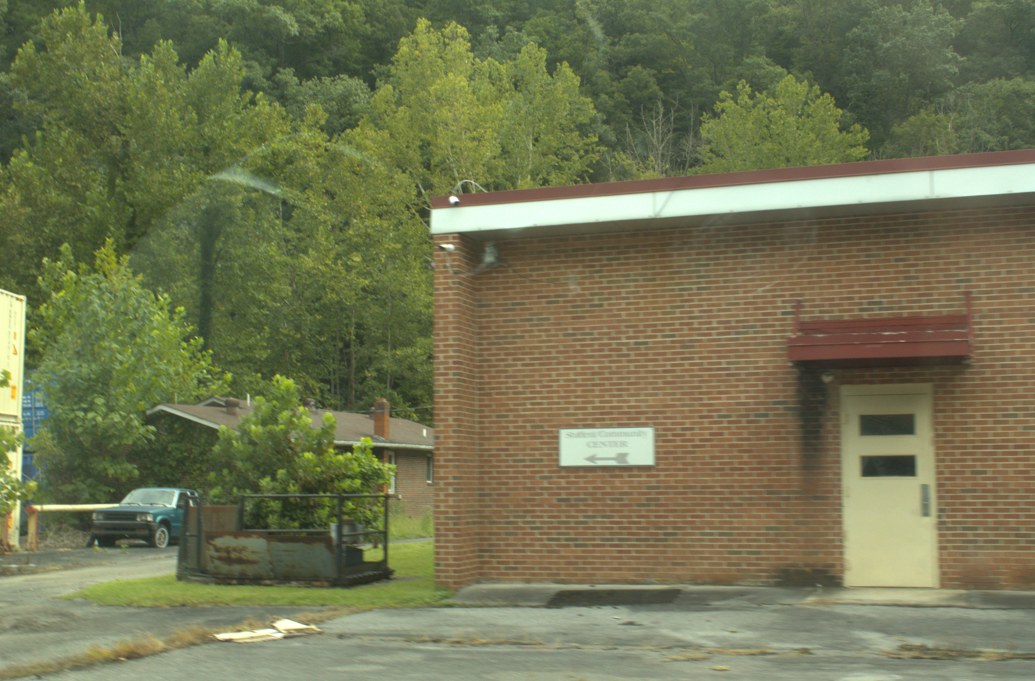
Additional field photographs
These instructor-provided photo albums offer additional context for the project area. Open them in a new tab.
- Former Vo-Tech site and Clinchco Elementary School photo album No Nora school photographs are included.
Dickenson project reference materials
These earlier studies and examples are shared across all four Dickenson teams. Start with the material relevant to your site, then compare its assumptions and ideas with current evidence and the work the client has requested.
Open the shared Dickenson folder
Haysi and Clintwood site-development concept study
Structr Advisors' 2023 study examines the former Haysi High School site and the Green-Barnette site near Clintwood. It includes site context, possible uses, regional examples and development approaches.
Open the 2023 concept study (PDF)
The study's Clintwood site is not automatically the same as your assigned housing or downtown-reuse site. Confirm the location before applying its findings. Its conditions and assumptions reflect the earlier study.
Dickenson County floodplain-property playbook presentation
A December 2025 student presentation explores possible reuse of cleared parcels and ideas for downtown Haysi. Study how it organizes property types, alternatives and visual explanations.
Open the earlier presentation (PowerPoint)
These are earlier concepts, not adopted plans or confirmed development permissions. Verify current parcel restrictions, flood information, infrastructure and client priorities. It does not establish Red Onion's industrial-site readiness.
Labeled parcel-layout maps
Earlier maps show parcels labeled as county-owned around Haysi, Clinchco, Nora, McClure and Birchleaf. Card numbers can help you connect the mapped locations to parcel records.
Open the labeled parcel layouts (PDF)
Use the labels as research leads. Check current county GIS and property records; these sheets alone do not establish present title, boundaries, permitted uses or suitability.
Parcel-layout maps without card-number labels
The companion sheet, dated November 1, 2025, provides a clearer view of the earlier mapped parcel pattern, roads and waterways.
Open the companion parcel layouts (PDF)
Read it alongside the labeled sheet. Keep the source date visible, and do not treat the earlier mapping as an up-to-date survey or a substitute for your own analysis.
Use these as references, not as a replacement for your project work. They do not change your committed scope or assignment requirements. Keep source dates and credits when you refer to them.
Confirmed geography
Where the work is focused
- Clinchco former-school siteReuse site
37.1669764, -82.3557539 - Former Ervinton Elementary School, 195 Ervinton Circle, NoraReuse site
37.0673300, -82.3432000
Loading confirmed project locations.
Community driving tour
Dickenson County driving tour: Clintwood to Haysi
This driving tour begins in Clintwood and continues to Haysi, providing visual context for the county's settlement pattern, transportation corridors, terrain, and community character. The route does not visit Red Onion Industrial Park.
Watch the GoPro tourProject purpose
Dickenson County asked for help exploring a workforce hub and reuse of former-school properties. This project covers the identified sites in Clinchco and Nora. The team should connect possible building uses to the people and programs they would serve, the organizations that could operate them, and the practical steps needed to move forward.
Scope of work
- Document available information about both former-school sites, their buildings, access, surrounding communities, workforce needs, possible users, and potential partners.
- Develop practical reuse and workforce-hub concepts that show programs, space relationships, access needs, partner roles, operating responsibilities, and how the two sites could have distinct or coordinated purposes.
- Identify capital needs, operating questions, funding and partnership leads, phasing, and the technical studies or decisions still needed.
Expected deliverables
- A concise profile of the two sites, prospective users, workforce needs, programs, and partners
- Illustrated reuse and operating concepts for Clinchco and Nora
- A preferred single-site or coordinated strategy, phased next steps, funding and partnership leads, presentation, and editable handoff files
Case studies and precedents
These examples can help you see different ways the work has been done. Treat them as starting points, not prescriptions. Check what is specific to each place and what still needs evidence for your project.
Appalachia, Wise County, Virginia
Former Appalachia Elementary School to workforce center
MECC used the former elementary school as a regional workforce-training center beginning in 2019. The college listed a closure announcement in July 2026, and regional reporting says some training moved to the main campus.
What to study: Use this nearby example to connect a reuse concept to program demand, schedules, staffing, transportation, recurring costs, partners, and a continuity plan.
Context: The closure does not establish that the reuse failed, and sources do not establish the building's next use. This is not the Nora or Clinchco property.
Pulaski, Virginia
Calfee Training School adaptive reuse
A state project description outlines reusing a former school for childcare, a community kitchen, digital learning and workforce training, cultural interpretation, events, and small-business incubation.
What to study: Compare program mix, intended users, operators, and how several activities might share a former education building.
Context: The source is a state strategy document describing the project proposal. Verify the current status of individual uses before treating them as operating.
Abingdon, Virginia
EO Regional Workforce and Child Development Hub
A former Kmart became a regional hub combining early learning, career exploration, employer connections, and shared services delivered with community partners.
What to study: See how a facility program connects users, training pathways, employers, service providers, and an operating partner.
Context: It is a regional comparison, not a school-reuse project or a promise that the same operating model fits Dickenson County.
Scope and review parameters
- The concept must address both the facility and the operating model; a floor plan without users, partners, governance, and funding is incomplete.
- Building-condition conclusions are limited to available records and documented observations and do not replace architectural, engineering, code, or environmental review.
- Program recommendations must identify the responsible organization, intended users, resource needs, and a credible path to sustained operation.
Treat the list above as the client's full set of needs, not a promise that every item will be completed this semester. In the Work Plan, commit to approximately 50% of what the team is confident it can complete well by the final deadline. The committed scope must be approved by the instructor and client. Additional work may be completed if time allows. The final product should explain how each facility could function, who would make the programs work, and what must be decided or investigated next.
Comparable places
Global Twins
These places face comparable terrain, settlement or economic challenges. Study the documented response, the conditions it depends on, and what differs here. A close analogy is a basis for analysis, not a design to copy or a claim about ancestral origin.
Explore the map and all comparisonsClinchco
A former coal and rail settlement in a narrow valley, with reuse and workforce opportunities.
Europe
Glyncorrwg
Neath Port Talbot, Wales · United Kingdom
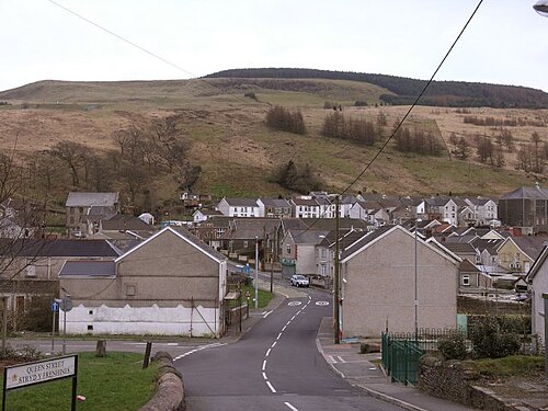
Former coal-mining settlement in the wooded Afan Valley, with steep uplands and a narrow valley floor.
Population: Village population can be assembled from 2021 Census Output Areas, but no ready-made current village total is reported in the reviewed ONS page; do not substitute the broader ward or former community total.
What happened here
A community cooperative secured Objective One Cydcoed support for an outdoor-pursuits centre, visitor centre and three mountain-bike trails using the forest landscape. The government case study records the assets and programme, not verified net jobs or income outcomes.
Why compare it with Clinchco?
A strong transition analogue for pairing post-coal identity with outdoor recreation, while local scale and visitor evidence need separate evaluation.
- Former coalfield valley settlement
- Steep wooded terrain and constrained valley-floor development
- Industrial heritage remains part of the area’s identity
- Outdoor access offers a potential complement to heritage interpretation
What students should study here
- Afan Forest Park uses trail networks and heritage features to support outdoor recreation
- Glyncorrwg’s mountain-bike centre combines trails with visitor services
- Build on existing access assets and community-serving facilities before proposing new attractions
- Measure local business participation and resident benefit; tourism presence alone is not an impact estimate
What differs: Glyncorrwg has an established nationally known mountain-bike destination and is close to the M4 corridor; Clinchco is more isolated and has different transport and market conditions.
Virginia project contextSources and geographic scope
Checked September 30, 2026. Population figures retain their year and statistical boundary; a municipal total is not a village count. Locator points are approximate, not surveyed boundaries.
- Afan Forest Park – Glyncorrwg Mountain Bike CentreNatural Resources Wales
- Population by age for Glyncorrwg, Blaengwynfi, Abergwynfi, Croserw and CymmerOffice for National Statistics
- Glyncorrwg Ponds Cooperative / CydcoedForest Research, UK Government
Glyncorrwg, Afan Valley: Approximate named-place locator, not a survey, parcel or settlement boundary. Coordinate source
Europe
Blaengwynfi
Neath Port Talbot, Wales · United Kingdom
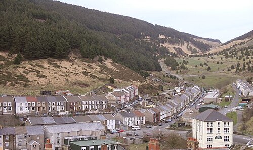
Small former coalfield settlement in the upper Afan Valley, surrounded by steep uplands and wooded slopes.
Population: Village population can be assembled from 2021 Census Output Areas; no ready-made current village total is reported in reviewed ONS source.
What happened here
The documented Afan Valley response was based at Glyncorrwg: a cooperative-supported outdoor centre, visitor centre and mountain-bike trails. This is a nearby/regional study lead, not evidence that the programme was located in Blaengwynfi or produced measured local outcomes there.
Why compare it with Clinchco?
A close settlement-form and post-industrial valley comparison; it is a study lead rather than evidence that a specific intervention has produced local economic recovery.
- Small settlement in a steep coalfield valley
- Former coal industry is central to local history
- Limited level land and valley access shape development choices
- Nearby natural landscape can complement heritage interpretation
What students should study here
- Treat the former industrial landscape as an asset for interpretation, with community voice and accurate history
- Connect routes to functioning services rather than building a stand-alone attraction
- Use local-level indicators to test whether visitor activity benefits residents
What differs: Blaengwynfi sits within the Afan Valley tourism catchment; Clinchco’s remoteness and market access are different. No comparable economic outcome is established by these sources.
Virginia project contextSources and geographic scope
Checked September 30, 2026. Population figures retain their year and statistical boundary; a municipal total is not a village count. Locator points are approximate, not surveyed boundaries.
- Population by age for Glyncorrwg, Blaengwynfi, Abergwynfi, Croserw and CymmerOffice for National Statistics
- Afan Forest Park – Glyncorrwg Mountain Bike CentreNatural Resources Wales
- Glyncorrwg Ponds Cooperative / CydcoedForest Research, UK Government
Blaengwynfi, Afan Valley: Approximate named-place locator, not a survey, parcel or settlement boundary. Coordinate source
Europe
Lewistown (Upper Ogmore Valley)
Bridgend County Borough, Wales · United Kingdom
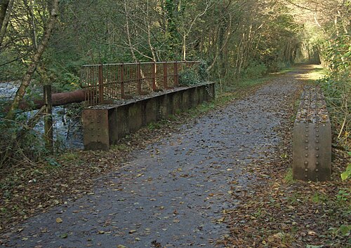
Locality in the Upper Ogmore Valley, between Ogmore Vale and Blackmill; mapped along the narrow valley corridor. Mining legacy is regional and village-specific claims need care.
Population: Village-only population not separately reported in reviewed primary sources. Census geography and any combined built-up-area total need confirmation before use.
What happened here
The regional heritage booklet documents a valley economy organized around deep and drift collieries and the Ogmore Valley Railway, which carried coal to Porthcawl docks. It provides historical context for Lewistown, not a village-specific modern redevelopment case.
Why compare it with Clinchco?
A supported small-valley and coalfield transition comparison, useful for considering how transport-corridor settlements adapt after mines close.
- Welsh Upper Ogmore Valley locality, distinct from the U.S. Lewistown
- Settlement lies along a constrained valley corridor
- Regional coal mining was a major historical land use
- Post-mining settlement functions include commuting and regional service connections
What students should study here
- The local heritage booklet frames the Ogmore Valley through coalfield history and landscape, offering a regional rather than single-village interpretation model
- Verify which legacy sites and routes are locally accessible before proposing visitor programming
- Treat commuter function and regional access as part of the transition story, not as evidence of local job creation
- Track village-scale outcomes separately from county-level change
What differs: Lewistown is in the Bridgend/Ogmore context and is reported as a commuter locality; Clinchco’s Appalachian setting, rail legacy and remoteness differ. The sources do not prove equivalent economic trajectories.
Virginia project contextSources and geographic scope
Checked September 30, 2026. Population figures retain their year and statistical boundary; a municipal total is not a village count. Locator points are approximate, not surveyed boundaries.
- Lewistown Map – Village – Ogmore ValleyMapcarta (OpenStreetMap-derived locator; secondary description)
- Coleg Cymunedol y Dderwen timetablesBridgend County Borough Council
- Ogmore Valley heritage bookletBridgend Reach
Lewistown, Upper Ogmore Valley, Wales (not the United States place of the same name): Approximate named-place locator, not a survey, parcel or settlement boundary. Coordinate source
Europe
Bustiello (Poblado Minero de Bustiello)
Asturias (Mieres) · Spain
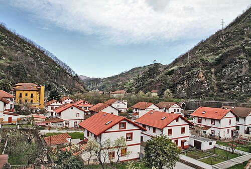
Purpose-built mining company settlement in a narrow Asturian valley, with housing and civic facilities clustered near the industrial basin.
Population: Current village-only population not separately reported in reviewed official source.
What happened here
The preserved company settlement’s former engineer’s house, chapel and worker/social buildings are interpreted through a guided visit; the regional authority documents the town’s historic services and designation as a cultural asset.
Why compare it with Clinchco?
A strong interpretive analogue for explaining how mining shaped a community, but Bustiello’s planned company-town architecture is not equivalent to Clinchco’s coal-and-rail morphology.
- Mining shaped settlement development and community identity
- Valley location connects built settlement to extractive landscape
- Industrial heritage can support place interpretation
- Small-scale visitor programming can use existing buildings
What students should study here
- Bustiello’s interpretation centre uses a former engineer’s residence and guided village visits
- Interpret the social history of labor and company power alongside architecture
- Link individual heritage sites into a regional mining itinerary
- Use bookings and visitor counts as outputs, not proof of broader economic impact
What differs: Bustiello is a designed company village built largely 1890–1925 and protected as an Asset of Cultural Interest; Clinchco has a different Appalachian coal/rail history and built form.
Virginia project contextSources and geographic scope
Checked September 30, 2026. Population figures retain their year and statistical boundary; a municipal total is not a village count. Locator points are approximate, not surveyed boundaries.
- Bustiello Mining Settlement Interpretation CentreTurismo Asturias
- Visitor Centre of the Bustiello Mining TownTurespaña / Spain.info
Bustiello mining village, Mieres: Approximate named-place locator, not a survey, parcel or settlement boundary. Coordinate source
Europe
Cwmaman
Rhondda Cynon Taf, Wales · United Kingdom
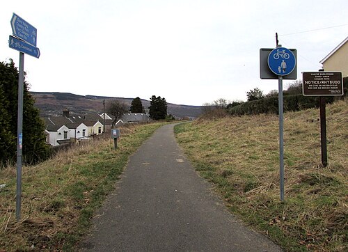
Coalfield village in the Cynon Valley near Aberdare, with compact miners’ housing and streets formed during rapid colliery-era growth.
Population: Current village-only population not separately reported in reviewed source; historical 1841 Aman Valley population of 40 is not a current village count.
What happened here
Workers organized a wage contribution and a public meeting led to the institute opened in 1892, with reading rooms and a public hall; it was rebuilt after a 1896 fire and later expanded. This is documented historic civic infrastructure, not a modern redevelopment claim.
Why compare it with Clinchco?
A supported coalfield-settlement comparison for how mining shaped village form, community facilities and local identity; it does not establish a specific post-closure reuse outcome comparable to an industrial park.
- South Wales coalfield village whose development followed nearby collieries
- Miners’ housing and streets grew rapidly with industrial employment
- Railway-era place names and industrial infrastructure are part of the settlement story
- Mining shaped social institutions and community life beyond the workplace
What students should study here
- Rhondda Cynon Taf’s heritage account links Cwmaman’s growth to three large collieries and describes worker housing and amenity needs
- It documents a miners’ institute built through worker contributions and community action, illustrating a social-infrastructure lesson rather than industrial-land conversion
- Map surviving civic and heritage buildings before proposing adaptive reuse
- Do not conflate this Cwmaman with Carmarthenshire’s Garnant/Glanaman community or import its Raven Industrial Park case
What differs: Cwmaman is a coal-mining village near Aberdare; Clinchco’s rail geography, isolation and contemporary assets differ. The cited Cwmaman source documents historical development, not present-day employment or land-reuse outcomes.
Virginia project contextSources and geographic scope
Checked September 30, 2026. Population figures retain their year and statistical boundary; a municipal total is not a village count. Locator points are approximate, not surveyed boundaries.
- CwmamanRhondda Cynon Taf County Borough Council
- Aberdare Conservation Area Appraisal and Management PlanRhondda Cynon Taf County Borough Council
Cwmaman village near Aberdare: Approximate named-place locator, not a survey, parcel or settlement boundary. Coordinate source
U.S. Appalachia
Benham
Harlan County, Kentucky · United States
Planned coal-company community in the Cumberland Mountains of southeastern Kentucky, with compact company-era civic and residential fabric.
Population: 512 residents, 2020 Census.
What happened here
The 1926 coal-camp school, used as a school until 1992, was rehabilitated as an inn beginning in 1993; the Kentucky Historic Schools Survey documents investor and former-graduate involvement and retention of historic fabric. No quantified local economic effect is claimed.
Why compare it with Clinchco?
A close Appalachian coal-company-town comparison with a specific, documented adaptive-reuse lesson in converting a former school into visitor accommodation.
- Small Appalachian coalfield community
- Company-era development shaped civic facilities and local identity
- Historic buildings remain potential community assets
- A post-industrial visitor offer can reuse existing structures rather than require a new building
What students should study here
- The former Benham school, built in 1926 for coal-camp children and used as a school until 1992, was converted into the Benham Schoolhouse Inn
- The Kentucky Historic Schools Survey reports local investors and former graduates funded rehabilitation, with historic fabric retained
- A reused school can combine lodging, dining and meeting functions, but needs a viable operating model and capital plan
- The documented inn is a project output; the source does not quantify net jobs or broader local economic impact
What differs: Benham’s schoolhouse inn is an operating private lodging asset in a coal-camp context; Clinchco needs its own building inventory, ownership review, visitor-market test and operating partner.
Virginia project contextSources and geographic scope
Checked September 30, 2026. Population figures retain their year and statistical boundary; a municipal total is not a village count. Locator points are approximate, not surveyed boundaries.
- State of Kentucky Incorporated Places – 2020 CensusU.S. Census Bureau
- Kentucky Historic Schools SurveyKentucky Heritage Council
- Benham School House Inn – Our HistorySoutheast Kentucky Community and Technical College / Kentucky Coal Museum
Benham city, Kentucky: Approximate named-place locator, not a survey, parcel or settlement boundary. Coordinate source
Canadian Appalachia
Inverness (Cape Breton)
Inverness County, Cape Breton Island, Nova Scotia · Canada
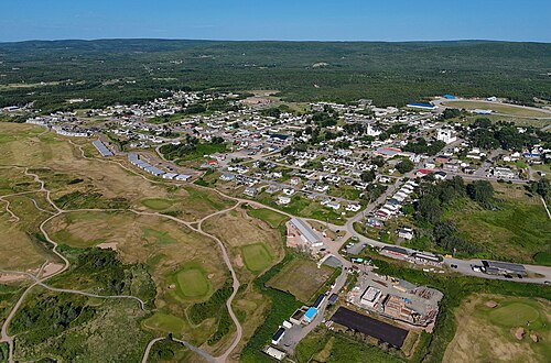
Coastal village on western Cape Breton Island beside the Gulf of St. Lawrence, with a beach, fishing harbour and rolling uplands; not a narrow inland valley analogue.
Population: Village-only population is not separately reported in the cited table; Inverness Subdivision C had 3,167 residents in the 2021 Census.
What happened here
The Inverness Miners Museum interprets the area’s coal-mining history, and the Historical Society documents local history walks. This is an active interpretation response; sources do not quantify resulting economic effects.
Why compare it with Clinchco?
A useful coal-heritage and recreation comparison, but its coastal setting and beach-based visitor draw differ materially from Clinchco’s inland coal-and-rail valley.
- Small community with a documented coal-mining past
- Mining history remains visible through a local heritage institution
- Outdoor recreation complements place interpretation
- Transition planning has to account for a resource-industry legacy
What students should study here
- The Inverness Miners Museum preserves and interprets local 19th- and 20th-century coal-mining history
- Cape Breton tourism information presents the beach, harbour, boardwalk and outdoor recreation as a wider visitor offer
- Connect heritage interpretation with existing recreation assets and local providers
- Do not transfer the coastal beach/harbour market strategy to an inland valley without demand evidence
What differs: Inverness is a Gulf coast village with sandy beach and harbour; it is not steep-sided or valley-confined like Clinchco. The comparison is about coal-memory interpretation and diversified recreation, not physical form.
Virginia project contextSources and geographic scope
Checked September 30, 2026. Population figures retain their year and statistical boundary; a municipal total is not a village count. Locator points are approximate, not surveyed boundaries.
- Population and dwelling counts: Nova Scotia census subdivisionsStatistics Canada
- Inverness Miners MuseumInverness Historical Society
- Attractions – Inverness, Cape BretonInverness Cape Breton tourism organization
- Physiographic Regions of CanadaNatural Resources Canada, Geological Survey of Canada
Inverness village, Cape Breton Island: Approximate named-place locator, not a surveyed boundary. Coordinate source
Nora
A small extractive-industry settlement and former-school project within a creek and transport corridor.
Europe
Glyncorrwg
Neath Port Talbot, Wales · United Kingdom
Former coal-mining settlement in the wooded Afan Valley, with steep uplands and a narrow valley floor.
Population: Village population can be assembled from 2021 Census Output Areas, but no ready-made current village total is reported in the reviewed ONS page; do not substitute the broader ward or former community total.
What happened here
A community cooperative secured Objective One Cydcoed support for an outdoor-pursuits centre, visitor centre and three mountain-bike trails using the forest landscape. The government case study records the assets and programme, not verified net jobs or income outcomes.
Why compare it with Nora?
A second, deliberate association emphasizing small isolated valley settlement and the possibility of converting legacy access/landscape assets into low-impact recreation.
- Small settlement in a narrow, wooded upland valley
- Mining legacy shapes place narrative
- Terrain and transport access constrain options
- Nature-based visitation is present in the surrounding landscape
What students should study here
- Reuse trails and existing facilities to connect heritage and outdoor recreation
- Plan for maintenance, safety and seasonal use as recurring costs
- Avoid promising employment or population gains without project-level evidence
What differs: Afan Forest Park has a developed trail system and active visitor infrastructure; Nora’s described isolation and flood vulnerability require a distinct hazard/access response.
Virginia project contextSources and geographic scope
Checked September 30, 2026. Population figures retain their year and statistical boundary; a municipal total is not a village count. Locator points are approximate, not surveyed boundaries.
- Afan Forest Park – Glyncorrwg Mountain Bike CentreNatural Resources Wales
- Population by age for Glyncorrwg, Blaengwynfi, Abergwynfi, Croserw and CymmerOffice for National Statistics
- Glyncorrwg Ponds Cooperative / CydcoedForest Research, UK Government
Glyncorrwg, Afan Valley: Approximate named-place locator, not a survey, parcel or settlement boundary. Coordinate source
Europe
Blaengwynfi
Neath Port Talbot, Wales · United Kingdom
Small former coalfield settlement in the upper Afan Valley, surrounded by steep uplands and wooded slopes.
Population: Village population can be assembled from 2021 Census Output Areas; no ready-made current village total is reported in reviewed ONS source.
What happened here
The documented Afan Valley response was based at Glyncorrwg: a cooperative-supported outdoor centre, visitor centre and mountain-bike trails. This is a nearby/regional study lead, not evidence that the programme was located in Blaengwynfi or produced measured local outcomes there.
Why compare it with Nora?
A second deliberate association for Nora’s small, steep, isolated mining-valley context, especially relevant to access and resilience questions.
- Compact settlement in steep valley terrain
- Mining and rail-era development shaped regional settlement patterns
- Constrained route choices and limited flatland
- Landscape and industrial memory are linked
What students should study here
- Coordinate heritage routes with transport and emergency-access planning
- Build a small-scale, locally anchored visitor story around existing assets
- Distinguish documented projects from proposed regeneration and measure their results
What differs: The Afan Valley contains established forest-recreation infrastructure; Nora’s described flood vulnerability and isolation call for additional hazard screening.
Virginia project contextSources and geographic scope
Checked September 30, 2026. Population figures retain their year and statistical boundary; a municipal total is not a village count. Locator points are approximate, not surveyed boundaries.
- Population by age for Glyncorrwg, Blaengwynfi, Abergwynfi, Croserw and CymmerOffice for National Statistics
- Afan Forest Park – Glyncorrwg Mountain Bike CentreNatural Resources Wales
- Glyncorrwg Ponds Cooperative / CydcoedForest Research, UK Government
Blaengwynfi, Afan Valley: Approximate named-place locator, not a survey, parcel or settlement boundary. Coordinate source
Europe
La Nueva (Valle de Samuño, Llangréu/Langreo)
Asturias (Llangréu/Langreo) · Spain
Small mining settlement in a wooded, narrow valley, linked historically to upper-valley mines by a coal railway and mine workings.
Population: Current La Nueva village-only population not separately reported in reviewed official sources.
What happened here
The Valle de Samuño Mining Ecomuseum reuses the mining railway and Pozo San Luis for a train-and-mine visitor route connected to La Nueva. It preserves and interprets industrial infrastructure; the source does not establish replacement employment or community-wide economic success.
Why compare it with Nora?
A strong post-extractive valley analogue for Nora’s scarce flatland and rail/creek setting, with a documented community-driven heritage reuse example.
- Small settlement embedded in a wooded extractive valley
- Mine and transport infrastructure shaped local form
- River and rail corridors organize access through constrained terrain
- Industrial legacy coexists with natural landscape
What students should study here
- A community-demanded project recovered the San Luis mine and railway route as the Valle de Samuño Mining Ecomuseum, opened in 2013
- The visitor experience connects train, former mining tunnel, shaft buildings and landscape interpretation
- Integrate industrial interpretation with protected-landscape routes
- Report the established attraction as an implemented heritage project; the sources do not establish net job or population effects
What differs: La Nueva is part of Asturias’ large historic coalfield and is embedded in a designated protected landscape; Nora’s local industrial scale, current assets and hazard exposure require independent verification.
Virginia project contextSources and geographic scope
Checked September 30, 2026. Population figures retain their year and statistical boundary; a municipal total is not a village count. Locator points are approximate, not surveyed boundaries.
La Nueva, Samuño Valley, Langreo: Approximate named-place locator, not a survey, parcel or settlement boundary. Coordinate source
Europe
Cwmtillery
Blaenau Gwent, Wales · United Kingdom
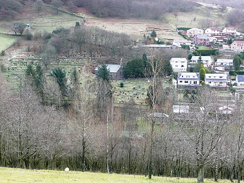
Welsh coalfield settlement in a wooded upland valley; a former colliery feeder pond and reclaimed mine land form a local landscape feature.
Population: Current village-only population not separately reported in reviewed official sources; verify the relevant census geography before using a number.
What happened here
The council identifies the former colliery feeder pond and reclaimed mine land as an open-access lakeside recreation and nature-reserve setting, with paths and mining-history interpretation. A separate proposed Outdoor Gateway was later recorded as not progressing, so it is not presented as delivered.
Why compare it with Nora?
A useful analogue for linking former extractive land, watershed landscapes and community recreation, with an explicit reminder that a proposed project is not an implemented outcome.
- Former mining landscape in a steep valley
- Water features and wooded slopes are visible parts of place identity
- Post-industrial land can serve ecological and community functions
- Recreation and heritage can be combined at a small scale
What students should study here
- The former Cwmtillery Colliery feeder pond and reclaimed mine area now provide open access, paths and seating
- Council identifies mining history through lakeside sculpture and local nature-reserve status
- A prior planning description proposed an outdoor gateway/education centre and trails; a later plan says that initiative is no longer progressing, so do not describe it as delivered
- Screen flood, ecology and site ownership before proposing new facilities
What differs: The implemented lakeside access and nature features are not evidence of a completed outdoor visitor centre or proven economic transition; Nora’s flood exposure needs its own assessment.
Virginia project contextSources and geographic scope
Checked September 30, 2026. Population figures retain their year and statistical boundary; a municipal total is not a village count. Locator points are approximate, not surveyed boundaries.
- Cwmtillery LakesBlaenau Gwent County Borough Council
- Local Nature ReservesBlaenau Gwent County Borough Council
- Blaenau Gwent Local Development Plan monitoring reportBlaenau Gwent County Borough Council
Cwmtillery, Blaenau Gwent: Approximate named-place locator, not a survey, parcel or settlement boundary. Coordinate source
Europe
Cwm Penmachno
Conwy, Wales · United Kingdom
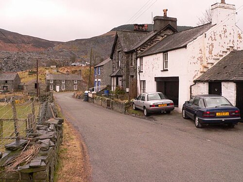
Village in the upper Conwy valley, built mainly to house workers at Cwm-machno slate quarry; associated with a remote upland slate landscape and historic quarry transport routes.
Population: Village-only population not separately reported; Bro Machno community population was 629 in Census 2021.
What happened here
The former chapel was converted into a village community centre, with a heritage room added in 2012; the former school was also adapted as a residential centre. These are documented building reuses, not quantified regeneration outcomes.
Why compare it with Nora?
A useful extractive-valley analogue for Nora’s small scale, constrained access and legacy infrastructure, with slate quarrying rather than coal mining as the key industry.
- Small Welsh settlement in a narrow upland valley
- Extractive industry shaped the settlement and local employment
- Historic transport links carried mineral output through the valley
- Community heritage assets reuse existing buildings and interpret local history
What students should study here
- Coflein records that the former school became a residential centre and a former chapel became a community centre with a heritage room
- The case shows reuse of civic buildings for continuing community and interpretation functions, not just visitor attractions
- Pair industrial interpretation with housing, services and everyday community use
- Do not infer population recovery or economic impact from building reuse alone
What differs: Cwm Penmachno’s slate-quarry landscape and Conwy geography differ from Nora’s specified coal/rail/creek context; no comparable flood outcome is asserted.
Virginia project contextSources and geographic scope
Checked September 30, 2026. Population figures retain their year and statistical boundary; a municipal total is not a village count. Locator points are approximate, not surveyed boundaries.
- Cwmpenmachno village site recordRoyal Commission on the Ancient and Historical Monuments of Wales (RCAHMW)
- About us – Bro Machno Community CouncilCyngor Cymuned Bro Machno
Cwm Penmachno, Bro Machno community: Approximate named-place locator, not a survey, parcel or settlement boundary. Coordinate source
U.S. Appalachia
Thurmond
Fayette County, West Virginia · United States
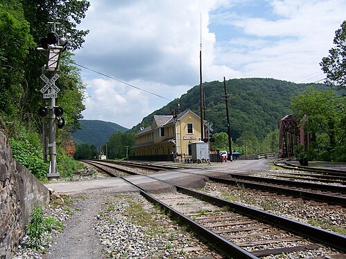
Former coal-and-rail town on a narrow strip in the New River Gorge, where steep rock slopes rise immediately behind the historic town and tracks follow the river corridor.
Population: 5 residents, 2020 Census.
What happened here
The National Park Service restored the depot as a seasonal visitor centre and maintains more than 20 historic structures, including ongoing stabilization work. This model depends on federal park stewardship, staff and funding; it is not evidence of a self-financing town-led redevelopment.
Why compare it with Nora?
A close terrain and former coal/rail comparison, but its current heritage model depends on National Park Service stewardship and must not be presented as a self-financing town-centred regeneration model.
- Very small Appalachian settlement in steep gorge terrain
- Coal and rail shaped the historic economy and built environment
- Limited flat land concentrates development in a narrow corridor
- Access and flood/river conditions shape how the place can be used
What students should study here
- National Park Service restored the depot as a seasonal visitor centre and maintains more than 20 historic structures
- NPS stabilization work includes drainage, vegetation removal and exterior repairs, showing ongoing stewardship costs
- The case depends on federal park ownership, staffing and preservation funding; this is a major institutional difference from a Virginia town acting alone
- Use Thurmond to study asset preservation and access management, not to forecast independent tourism revenue or demographic recovery
What differs: Thurmond sits within New River Gorge National Park and Preserve and has exceptionally low resident population; Nora’s services, ownership, river conditions and institutional support are not equivalent.
Virginia project contextSources and geographic scope
Checked September 30, 2026. Population figures retain their year and statistical boundary; a municipal total is not a village count. Locator points are approximate, not surveyed boundaries.
- State of West Virginia Incorporated Places – 2020 CensusU.S. Census Bureau
- Thurmond TodayU.S. National Park Service
- Thurmond – New River Gorge National Park & PreserveU.S. National Park Service
Thurmond town, West Virginia: Approximate named-place locator, not a survey, parcel or settlement boundary. Coordinate source
Canadian Appalachia
Murdochville
La Côte-de-Gaspé, Gaspésie–Îles-de-la-Madeleine, Québec · Canada
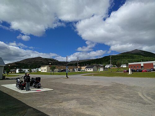
Inland copper company town at about 535 metres elevation in central Gaspésie, surrounded by high mountains, forest and lakes; not a coal town and not a narrow river-confluence analogue.
Population: 643 residents, 2021 Census.
What happened here
The municipality promotes named four-season activities including hiking, mountain biking, skiing, snowmobiling, kayaking and fishing after copper mining ended in 1999. This documents the current offer, not replacement jobs, income or quantified visitor success.
Why compare it with Nora?
A useful company-town transition comparison for Nora’s remote, resource-dependent setting, but the industry was copper and its high forested plateau setting is distinct from Nora’s coal/creek context.
- Small, remote Canadian Appalachian community shaped by a single extractive industry
- Company development influenced municipal formation and housing
- Resource dependence created vulnerability when mining ended
- Outdoor recreation is promoted as a later diversification pathway
What students should study here
- Municipal history records the copper mine closure in October 1999 after ore reserves were exhausted
- Official tourism materials now promote year-round outdoor activities including hiking, mountain biking, skiing and snowmobiling
- Consider how legacy infrastructure, services and workforce needs change after a dominant employer closes
- The sources establish a current recreation offer, not the scale of new jobs or replacement income
What differs: Murdochville was built around copper mining at high elevation among forested mountains and lakes; Nora’s stipulated coal, rail, creek and flood-vulnerability profile differs. Canadian Appalachian physiography is not the U.S. Appalachian Regional Commission service region.
Virginia project contextSources and geographic scope
Checked September 30, 2026. Population figures retain their year and statistical boundary; a municipal total is not a village count. Locator points are approximate, not surveyed boundaries.
- Murdochville – municipal historyVille de Murdochville
- Murdochville – Official Québec ToponymyCommission de toponymie du Québec
- Population Profile – MurdochvilleCentris, citing Statistics Canada 2021 Census
- Tourism – MurdochvilleVille de Murdochville
- Physiographic Regions of CanadaNatural Resources Canada, Geological Survey of Canada
Murdochville, Québec: Approximate named-place locator, not a surveyed boundary. Coordinate source
Work from the confirmed scope.
Use the community conversation, instructor-provided project needs, and existing documents to keep your work aligned with the client. Confirm any scope change with Tyler before promising it to the community partner.
See all projects